Featured Items
Results 1 - 11
(of 11)
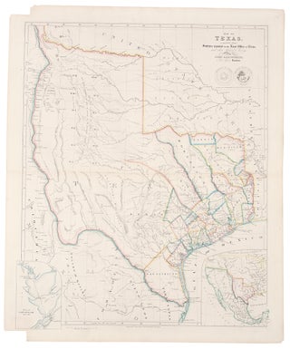
ARROWSMITH, John (1790-1873)
Map of Texas, compiled from Surveys recorded in the Land...
Price: $17,500.00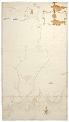
BERNARD, Sir Francis (1712-1779), and Francis MILLER (1733-1800), after surveys...
Manuscript Map of the Kennebec River in Maine, from its...
Price: $39,500.00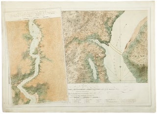
DES BARRES, J. F. W. (1721-1824), publisher - Samuel HOLLAND...
A plan of Fort Montgomery and Fort Clinton, taken by...
Price: $22,500.00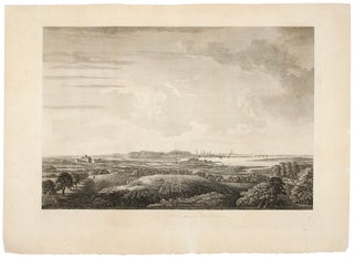
DES BARRES, J. F. W. (1721-1824); after William PIERIE
A View of Boston, Taken on the Road to Dorchester...
Price: $17,500.00![Item #33412 [Buzzards Bay and Vineyard Sound.]. JOSEPH FREDERICK WALLET DES BARRES, SAMUEL HOLLAND](https://donaldheald.cdn.bibliopolis.com/pictures/33412.jpg?width=320&height=427&fit=bounds&auto=webp&v=1491932250)
DES BARRES, JOSEPH FREDERICK WALLET (1721-1824) and SAMUEL HOLLAND
[Buzzards Bay and Vineyard Sound.]
Price: $28,500.00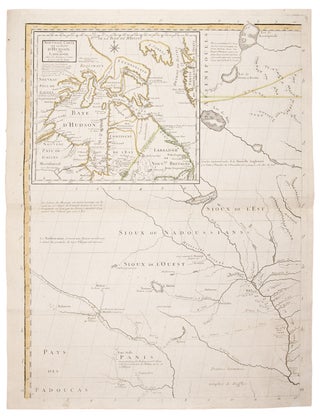
MITCHELL, John (1711-1768). - Georges Louis LE ROUGE (1712-1790)
Amerique septentrionale avec les Routes, Distances en miles, Villages et...
Price: $27,500.00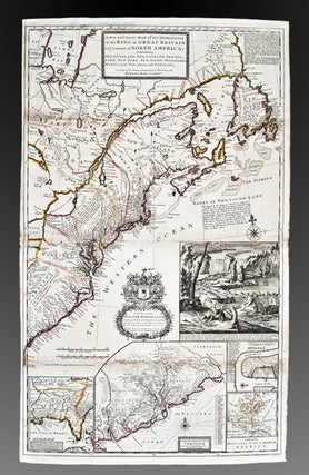
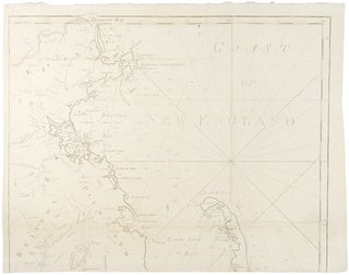
NORMAN, John; and Osgood CARLETON
Chart from New York to Timber Island including Nantucket Shoals...
Price: $39,500.00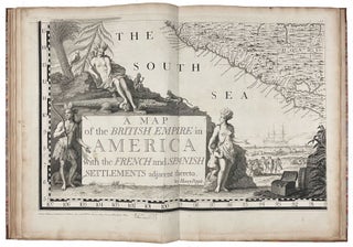
POPPLE, Henry (1695-1743, Cartographer). TOMS, William Henry (c.1700-1765, Engraver), BARON...
A Map of the British Empire in America, with the...
Price: $165,000.00
Results 1 - 11 (of 11)