
CAREY, Mathew (1760-1839)
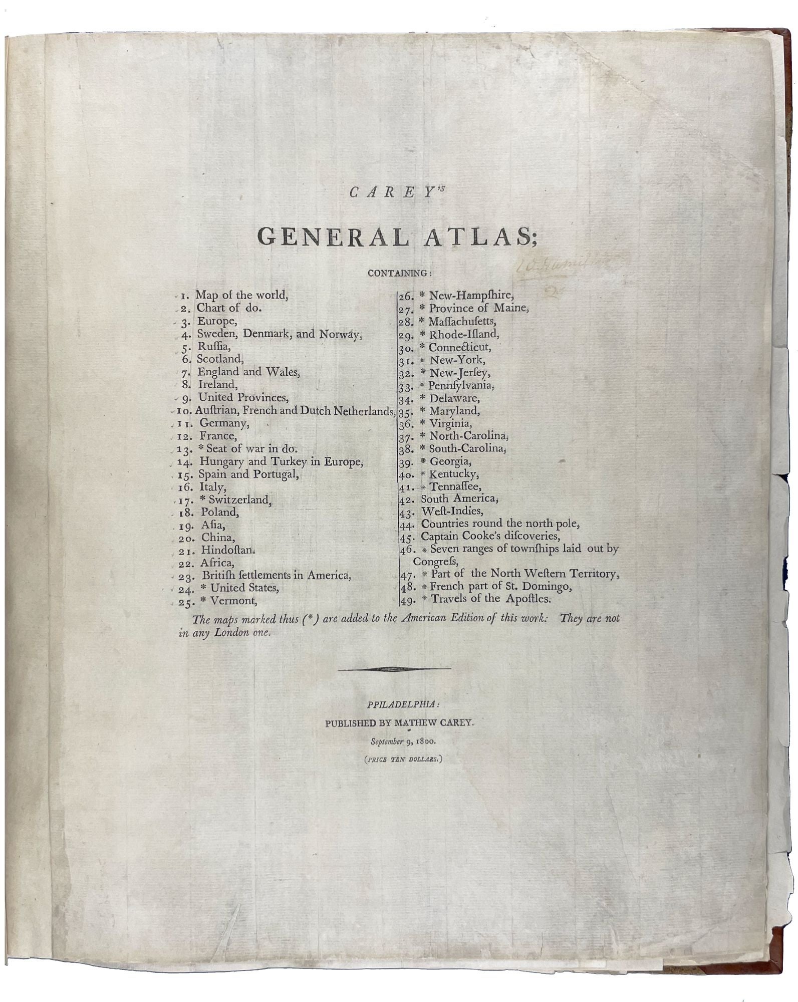
Carey's General Atlas
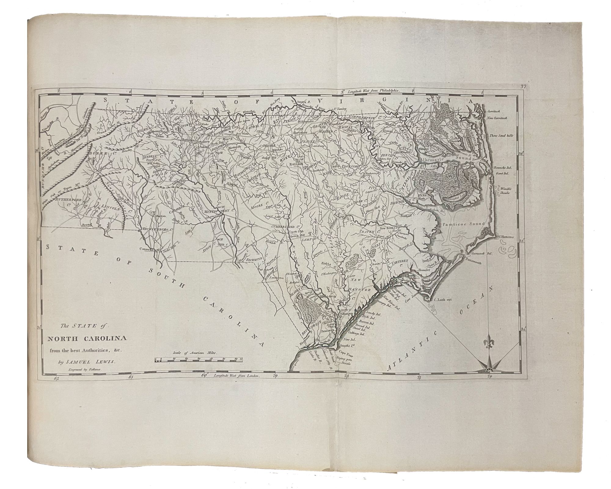
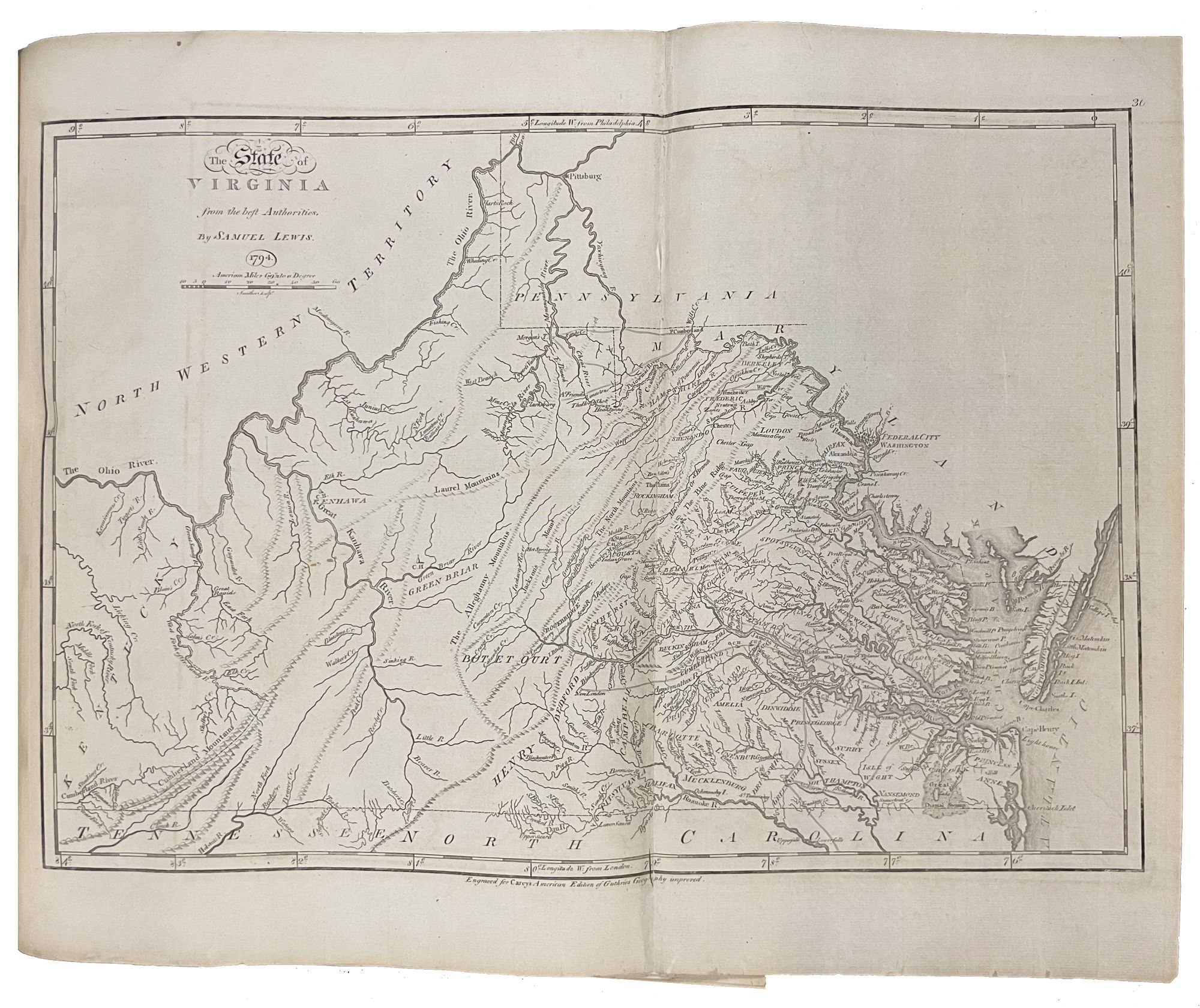
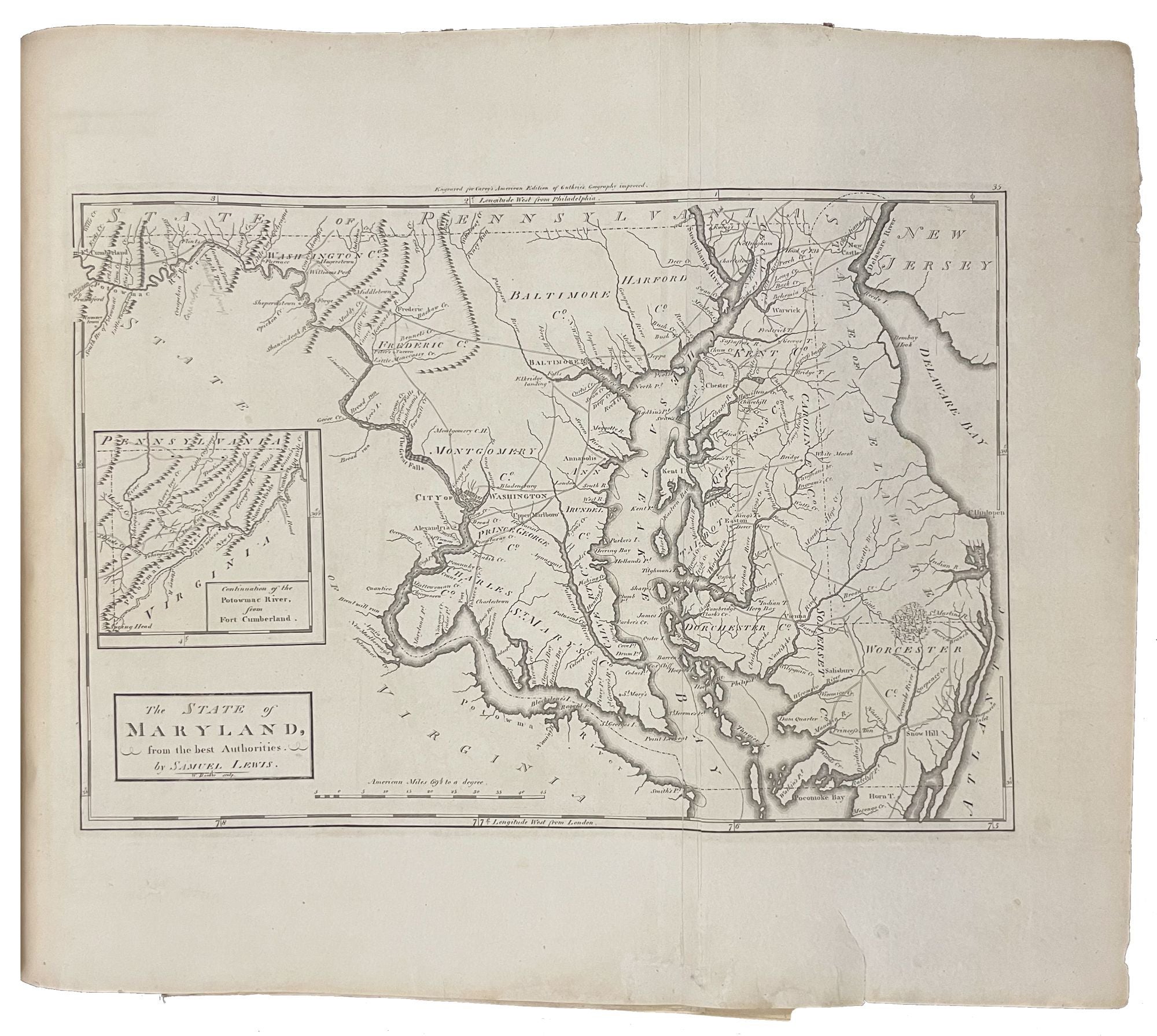
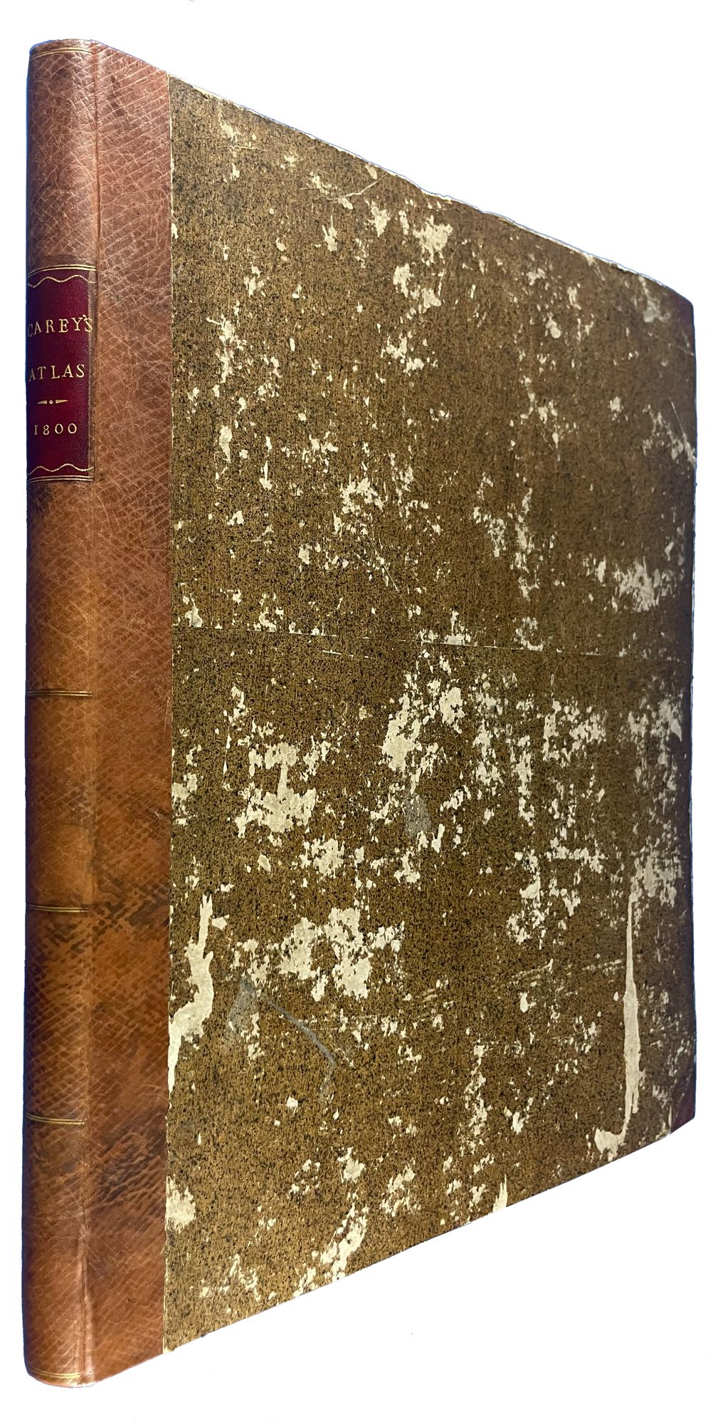
Philadelphia: Mathew Carey, September 9, 1800. Folio. (17 x 14 inches). 49 engraved maps, including 25 folding, and "A Map of Part of the N. W. Territory of the United States" with contemporary hand-coloring printed on heavy laid paper and dated 1796. 4 maps dated 1794, 2 dated 1795. With the title / table of contents page dated 1800, priced ten dollars, and with Philadelphia spelled "Ppiladelphia"
Bound to style in half calf over contemporary speckled paper-covered boards, the flat spine divided into six compartments by double gilt fillets, red morocco lettering-piece in the second compartment with gilt title
An exceedingly rare edition of Carey's important and early General Atlas, here with remaindered US state maps dating to 1794 and 1795.
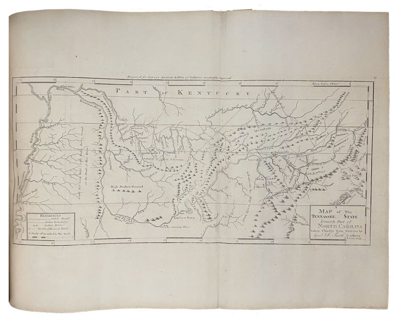
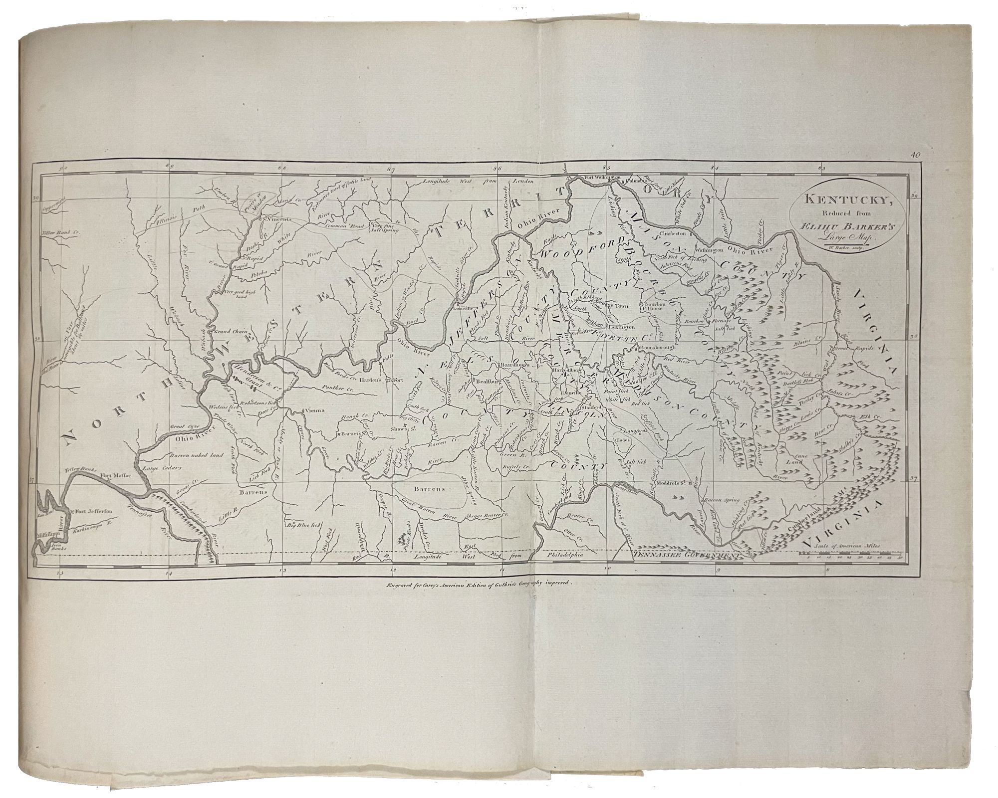
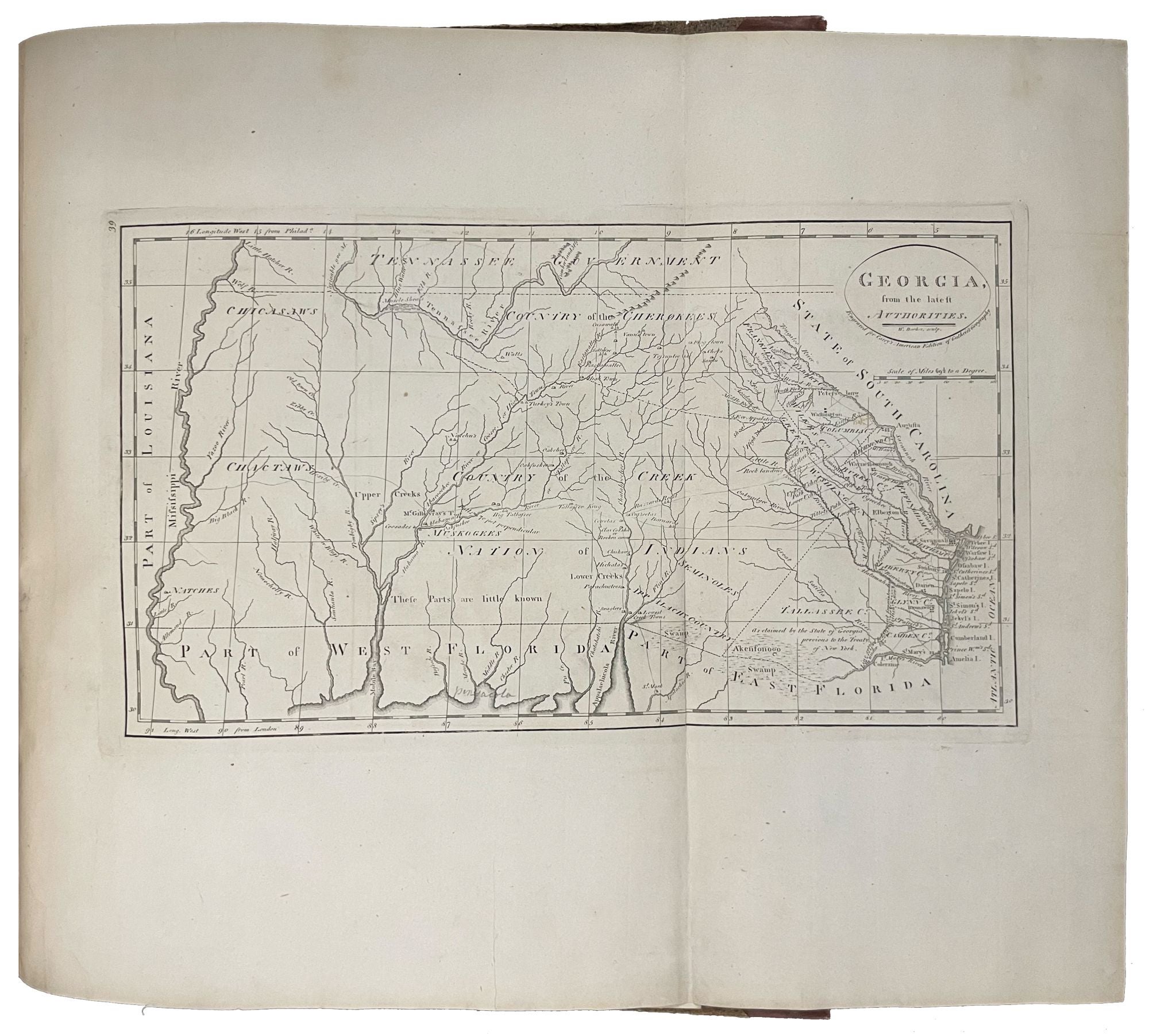
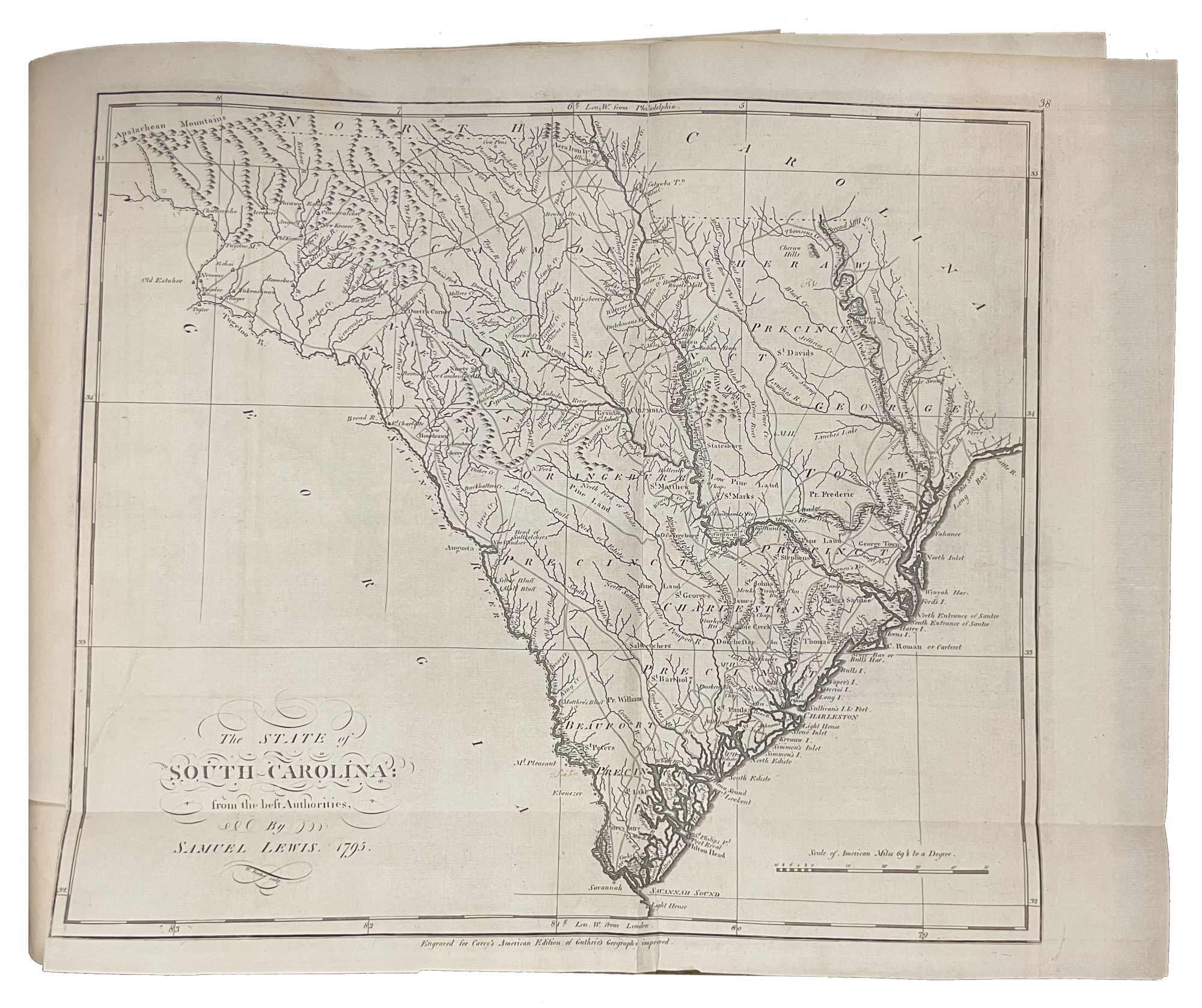
Carey, one of the most important publishers in American history, first issued his American Atlas in 1795 with 21 maps. Carey's was the first atlas printed in America. His General Atlas followed in 1796 with 45 maps. Most of the present atlas is devoted to the Americas with 27 of the 49 maps being of the New World. Of the 27, the majority concern the United States and its territories, and incorporate the latest geographical knowledge available to what was to become one of the premier mapping firms in the United States. Two additional important maps, not included in the 1796 edition, are Map 46, "Seven Ranges of Townships . . . laid out by Congress," which shows a section of what is now Ohio to be sold off by the federal government, and Map 47, "Part of the North Western Territory" by Samuel Lewis, dated 1796, which shows what is now the Greater Midwest. Beyond maps of Asia, Africa, South America, numerous European states, and even the North Pole and the whole world, there are detailed maps of each state then in the Union, including Georgia, Vermont, New Hampshire, Maine, Massachusetts, Rhode Island, Connecticut, New York, New Jersey, Pennsylvania (after Reading Howell), Delaware, Maryland, Kentucky (after Elihu Barker), South Carolina, North Carolina, a Virginia map dated 1794, one of the first printed maps of Tennessee (spelled "Tennassee"), and a map of the Ohio Territory before its naming in 1802.
Phillips, Atlases 3535. Sabin 10858. Not in Rumsey.
Item #14158
Price: $32,000.00