
MEAD, Braddock, alias John Green
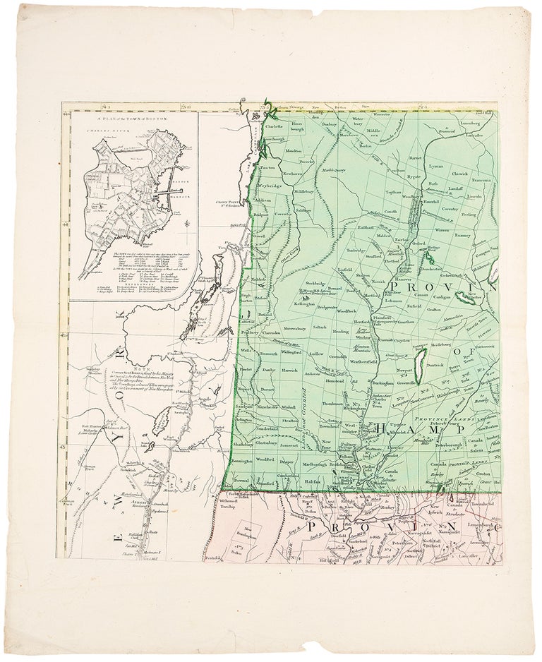
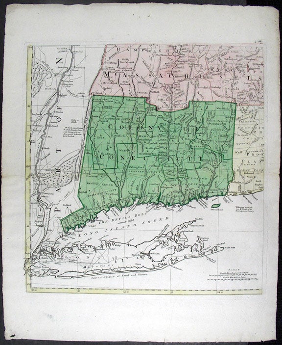
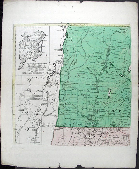
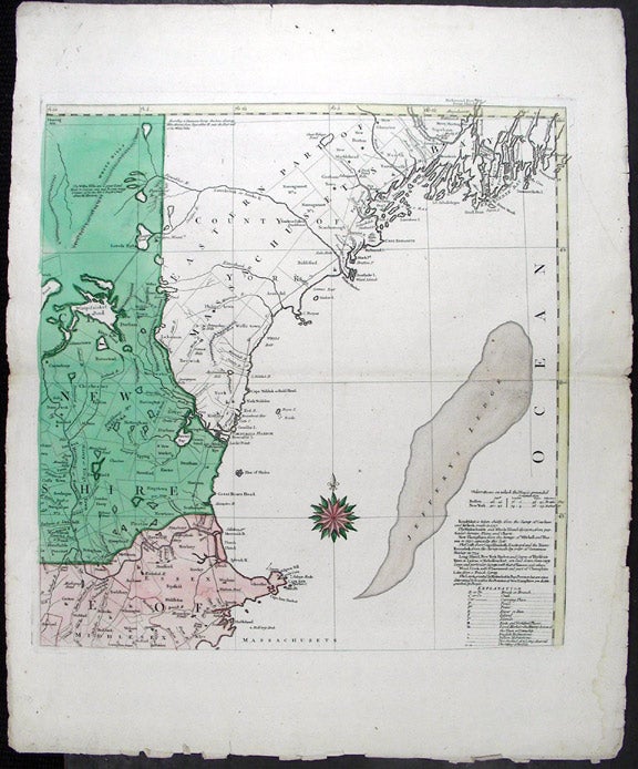
A Map of the most Inhabited part of New England containing the Provinces of Massachusets Bay and New Hampshire, with the Colonies of Connecticut and Rhode Island, Divided into Counties and Townships. The whole composed from Actual Surveys and its Situation adjusted by Astronomical Observations
[Augsburg]: Tobias Conrad Lotter, [1776]. Hand-coloured engraving by T. C. Lotter, on four sheets. Good condition. Each sheet: 27 1/4 x 22 3/4 inches approx.
One of the great maps of New England.
This large, intriguing map of New England was originally drawn by a shadowy figure named Braddock Mead, an Irishman and a geographer, who had to change his name to escape prosecution for kidnapping and related charges. He chose the name John Green and continued his geographical and cartographical work with several different publishers, ending up with Thomas Jefferys, the leading map publisher in London at that time. Only one map actually bears the name "J. Green", but there are characteristic traits to Mead/Green's maps that make the attributions fairly certain, and Jefferys states that he worked on "many of my Geographical performances..." G. R. Crone brought Green's identity to light in two Imago Mundi articles in the early 1950s. The map was the first large scale printed map of New England. Six different states of the map appeared in London between 1755 and 1794. This edition was engraved by Tobias Conrad Lotter, Matthew Seutter's son-in-law, in Augsburg, in 1776 based on the 4th state of the map. It is an exact copy of the Jefferys' map with the inset maps of Boston and of Boston Harbor and the vignette of the Pilgrims' landing at Plymouth in the cartouche. Interest in events taking place in New England in 1776 was of course intense, and the sharply drawn inset maps of Boston would have been especially appreciated. The map is rich in fascinating information for New Englanders, and it is displayed with great clarity. From a historical viewpoint, Mead's map shows the extent of European dominion in the region after a century and a half of settlement and growth.
G. R. Crone, "John Green. Notes on a neglected Eighteenth Century Geographer and Cartographer," Imago Mundi, VI (1950) p. 89-91; Crone, "Further Notes on Braddock Mead, alias John Green..." Imago Mundi, VIII (1951) p. 69; Mapping Colonial America. Degrees of Latitude. # 35; Cumming, British Maps of Colonial America, p. 45-47.
Item #19102
Price: $7,500.00