
THORNTON, John (1641-1708) & Samuel (fl.1703-39)
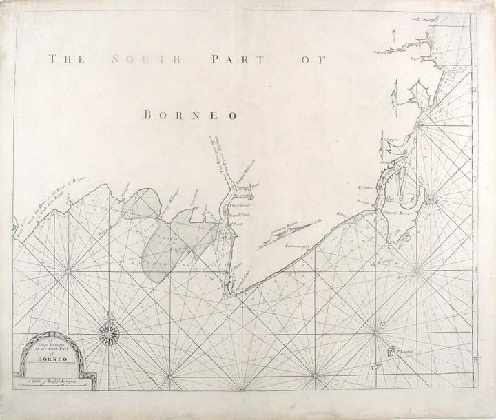
A Large Draught of the South Part of Borneo
London: William Mount & Thomas Page, [1734]. Copper-engraved sea chart, in excellent condition apart from a skillfully repaired marginal split at the base of the centerfold and marginal soiling. Sheet size: 19 x 22 3/4 inches.
A very attractive sea chart of southern Borneo, from the celebrated Third Book of the 'English Pilot'
This very attractive sea chart depicts Kalimantan, now the Indonesian section of Borneo and the adjacent part of the Java Sea. While the delineation of the coast is geographically well assured, the interior of the island is shown to be virtually unknown. Inhabited by fierce indigenous tribes and exotic animals, agents of the Dutch East Indian Company, who then nominally controlled the coasts, were afraid to venture into the interior. Indeed, parts of Borneo have not even been fully explored to this day. The Java Sea is elegantly adorned with rhumb lines that radiate from a compass rose and from centerpoints placed on an invisible circle. A handsome title cartouche embellishes the lower left corner of the composition. In 1671, the London cartographer John Seller (fl.1664-97) commenced work on The English Pilot, a work that intended to challenge Dutch hegemony in the sea atlas market. Intended to be published in four books covering different regions of the globe, Seller published an uncompleted book on 'Oriental navigation' in 1675. Unable to continue this Herculean endeavour, Seller sold his rights to John Thornton, the official hydrographer to the English East India Company. Thornton took up the project with great fervour, publishing his first editions in 1689. Thornton did not publish his first edition of the Third Book, detailing navigation in the East Indies, until 1703. While Thornton largely based his charts on those of earlier Dutch cartographers, most notably those found in Pieter Goos' Zee-Spiegel and Lucas Janz Waghenaer's Mariner's Mirror, The English Pilot proved to be enormously popular. When John Thornton died in 1708, his brother Samuel took over the business and added to and modified existing charts. All four books were produced in editions until the 1760s, the Third Book ran into twelve editions up to 1761. The project succeeded in giving the English dominance in the sea chart market as the eighteenth-century progressed.
National Maritime Museum (Greenwich), chart G258:2/17; Cf. Phillips, Atlases, 4278-38; Verner & Skelton (eds.), John Thornton - The English Pilot: The Third Book (Facsimile 1703 edition).
Item #19536
Price: $450.00