THORNTON, John (1641-1708) & Samuel (fl.1703-39)
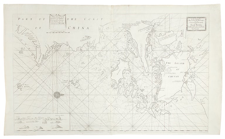
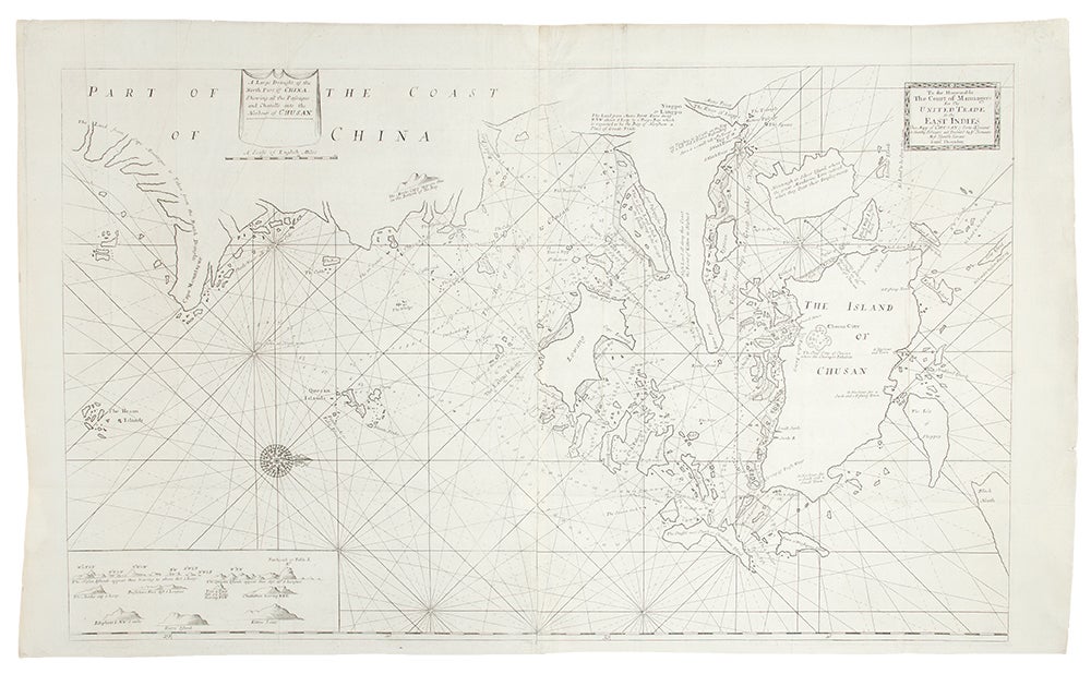
A Large Draught of the North Part of China Shewing the Passages and the Chanells into the Harbour of Chusan
London: William Mount & Thomas Page, [1734]. Copper-engraved sea chart, in excellent condition, apart from an expertly repaired centre fold, and mild creases where the map folded. Sheet size: 23 x 35 1/2 inches.
A very fine sea chart of China's Zhejiang Province, from the celebrated Third Book of 'The English Pilot.'
This elegant and large sea chart captures China's modern day Zhejiang province. Located on the East China sea, just below the Yangtze Delta, this region was of major interest to European traders during the eighteenth-century. It features the major port of Zhousan (Chusan), and was the location of the entrance of the Grand Canal of China. The canal, construction of which began in the 5th-century B.C., was then the oldest and longest man-made waterway in the world, which allowed barges to travel hundreds to Beijing. In 1671, the London cartographer John Seller (fl.1664-97) commenced work on The English Pilot, a work that intended to challenge Dutch hegemony in the sea atlas market. Intended to be published in four books covering different regions of the globe, Seller published an uncompleted book on 'Oriental navigation' in 1675. Unable to continue this Herculean endeavour, Seller sold his rights to John Thornton, the official hydrographer to the English East India Company. Thornton took up the project with great fervour, publishing his first editions in 1689. Thornton did not publish his first edition of the Third Book, detailing navigation in the East Indies, until 1703. While Thornton largely based his charts on those of earlier Dutch cartographers, most notably those found in Pieter Goos' Zee-Spiegel and Lucas Janz Waghenaer's Mariner's Mirror, The English Pilot proved to be enormously popular. When John Thornton died in 1708, his brother Samuel took over the business and added to and modified existing charts. All four books were produced in editions until the 1760s, the Third Book ran into twelve editions up to 1761. The project succeeded in giving the English dominance in the sea chart market as the eighteenth-century progressed.
Cf. Phillips, Atlases, 4278-36; Verner & Skelton (eds.), John Thornton - The English Pilot: The Third Book (Facsimile 1703 edition).
Item #19538
Price: $750.00