
[MEAD, Braddock, alias John GREEN (c.1688-1757)]
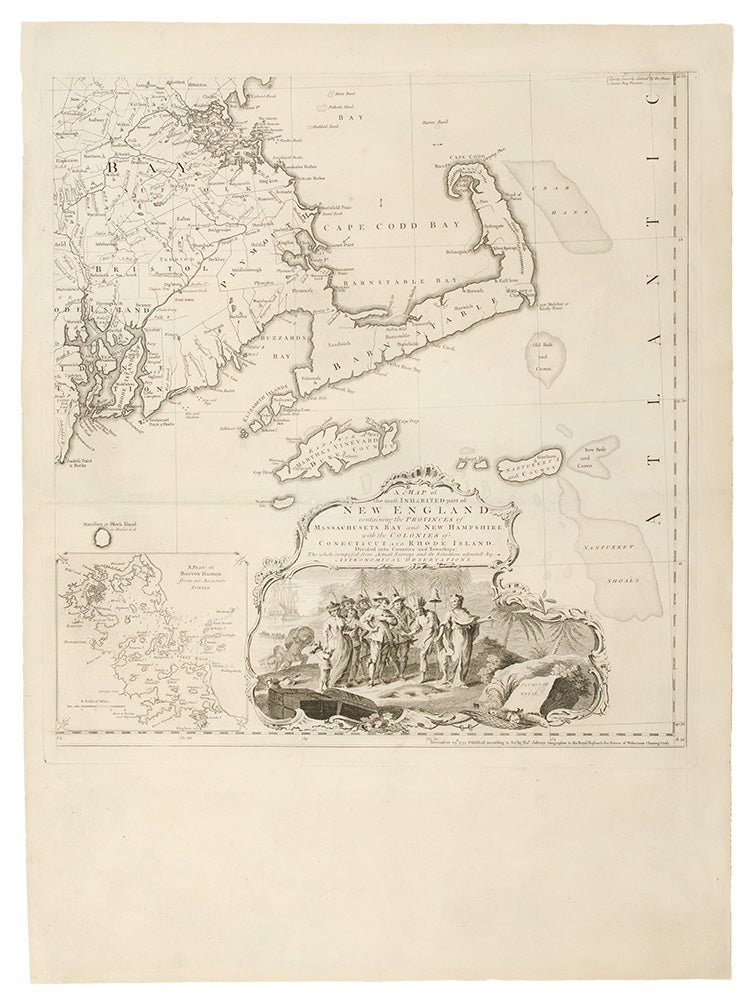
A Map of the most Inhabited part of New England containing the Provinces of Massachusets Bay and New Hampshire, with the Colonies of Conecticut and Rhode Island, Divided into Counties and Townships: The whole composed from Actual Surveys and its Situation adjusted by Astronomical Observations
London: Thomas Jefferys, November 29th, 1755 [but circa 1764]. Copper-engraved map, on four unjoined and untrimmed sheets as issued. Sheet size: of each 29 3/8 x 21 3/8 inches.
The largest and most detailed map of New England that had yet been published, and one of the great maps of the east coast of America, by one of the greatest figures in 18th-century cartography: 'Mead's contributions to cartography stand out ... At a time when the quality and the ethics of map production were at a low ebb in England, he vigorously urged and practiced the highest standards' (Cumming, p.47).
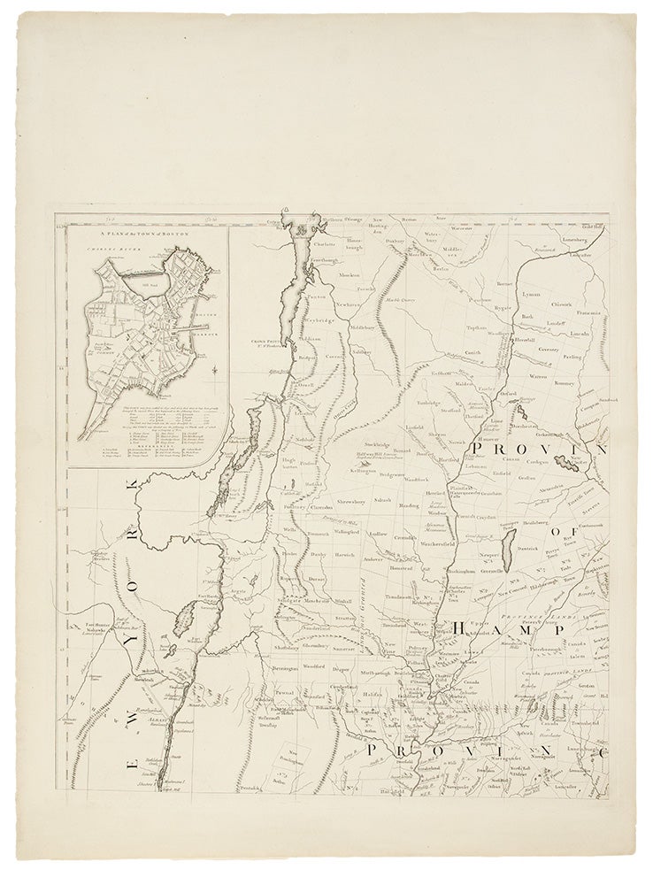
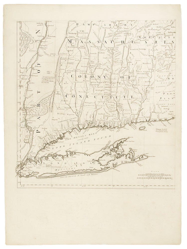
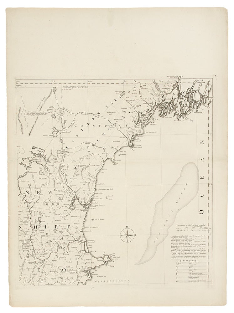
This is the grandest, most accurate and detailed map of New England produced during the British colonial period. It depicts the entire region from Long Island Sound up north to line of 44'30 of latitude. While it shows that the coastal areas, and the lower Connecticut Valley were well settled, areas of the interior, especially in New Hampshire and the future Vermont were just developing, with the early boundaries of townships having recently been established by surveyors. Importantly, this map contains two highly-detailed cartographic insets, one of the city of Boston (upper-left), and another of Boston Harbor on the lower-right sheet. The map is also adorned with a very handsome pictorial title cartouche, depicting the arrival of the Pilgrims at Plymouth Rock in 1620. The present map is the first issue of the second edition of this work, and has been significantly updated from the original issue of 1755. The map's publisher, Thomas Jefferys was the leading British mapmaker of the mid-eighteenth century. He became geographer to the Prince of Wales in 1746 and then to King George III in 1760. He published a remarkable number of maps and charts, and is best known for his work The American Atlas (1775) This map's maker, John Green, was an intriguing and larger-than-life figure, who has been called "the genius behind Jefferys." In addition to his extensive cartographic abilities, Green's personal history also stands out from amongst the biographies of other 18th-century British map makers. Green was born Braddock Mead in Ireland around 1688, married in Dublin in 1715 and moved to London in 1717. He was imprisoned in 1728 for trying to defraud an Irish heiress, and assumed his alias after his release from prison. He worked with Ephriam Chambers on his Universal Dictionary before joining the employ of Cave, Astley, and Jefferys. William Cumming remarked that he 'had a number of marked characteristics as a cartographer ... One was his ability to collect, to analyze the value of, and to use a wide variety of sources; these he acknowledged scrupulously on the maps he designed and even more fully in accompanying remarks. Another outstanding characteristic was his intelligent compilation and careful evaluation of reports on latitudes and longitudes used in the construction of his maps, which he also entered in tables on the face of the maps ... Mead's contributions to cartography stand out ... At a time when the quality and the ethics of map production were at a low ebb in England, he vigorously urged and practiced the highest standards; in the making of maps and navigational charts he was in advance of his time. For this he deserves due credit.' (Cumming, p.45)
Degrees of Latitude, 35; McCorkle, New England in Early Printed Maps, 755.19 (first edition/state); Sellers & Van Ee, Maps & Charts of North America & West Indies, 799; Stevens & Tree, "Comparative Cartography," 33(c), in Tooley, The Mapping of America. Cf. Crone, "John Green. Notes on a neglected Eighteenth Century Geographer and Cartographer," Imago Mundi, VI (1950) p. 89-91; Crone, "Further Notes on Braddock Mead, alias John Green" Imago Mundi, VIII (1951) p. 69; Cumming, British Maps of Colonial America, pp.45-47.
Item #19736
Price: $25,000.00