
CAREY, Henry Charles and Isaac LEA (publishers)
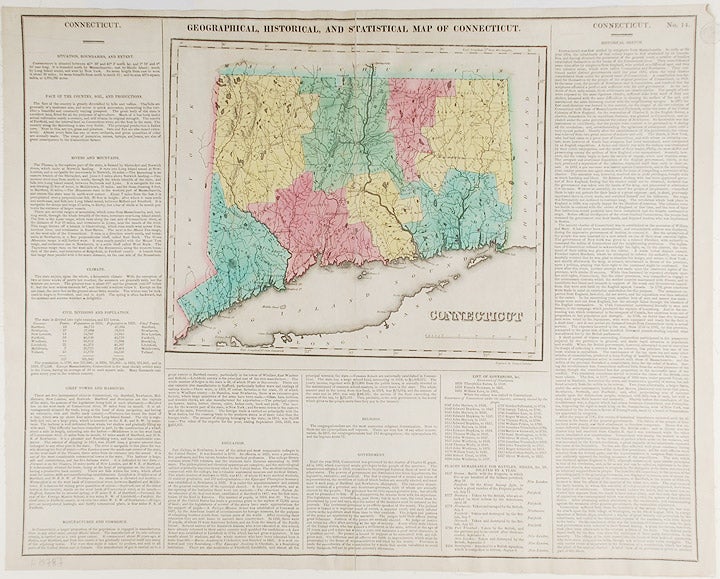
Connecticut. Geographical, Historic and Statistical Map of Connecticut
Philadelphia: Carey & Lea, 1823. Engraving with full period colour. Backed on linen. Split at fold expertly repaired. Occasional creases. Sheet size: 17 1/4 x 21 3/4 inches.
Fascinating and informative map of Connecticut from one of the most innovative American atlases of the 19th century.
Carey & Lea's atlas established a style that was widely admired, especially in Europe: placing a fully coloured map as the centerpiece of the page and surrounding it with geographical and historical facts. The texts were well written and intriguing. The immense transformation of continental America: the vast migration, settlement and industrialization really began at about this time, not long after the War of 1812, when expansion and opportunity were American by-words. It was at this time that American atlases began to need semi-annual revisions because the country had changed so rapidly. In fact, the Carey & Lea gazetteer style, most reminiscent of Herman Moll really, was too time consuming for the firms that published atlases of America as the century progressed.
Item #19787
Price: $200.00