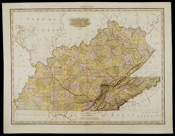

TANNER, Henry Schenck (1786-1858)
Kentucky and Tennessee ... Improved to 1825
Philadelphia: H. S. Tanner, 1825. Copper-engraving with full period color. Sheet size: 23 7/8 x 30 3/4 inches. Plate mark: 23 3/8 x 30 11/16 inches.
Tanner's 1825 map of Kentucky and Tennessee.
Henry Tanner's A New American Atlas was the most distinguished atlas published in America during the nineteenth century. The maps were carefully constructed from the best and most recent surveys. They were finely engraved on a large-scale, printed on high quality paper, and carefully hand colored. Because of the great expense involved in the production and publication, the atlas was published in five parts between 1819 and 1823. This map was first published in 1823 in the fifth part of Henry Tanner's A New American Atlas under the title "Kentucky, Tennessee and part of Illinois." In this second issue, from the 1825 edition of the atlas, Illinois has been dropped from the title and the map has been augmented by the addition of new counties (particularly in southwestern Tennessee) and the additions of various cities and roads.
Phillips Atlases 3669-13; cf. Ristow, American Maps and Mapmakers, pp. 191-198; Rumsey 2755.013; cf. Sabin 94323.
Item #23467
Price: $4,500.00