
SAYER, Robert and John BENNET (publishers)
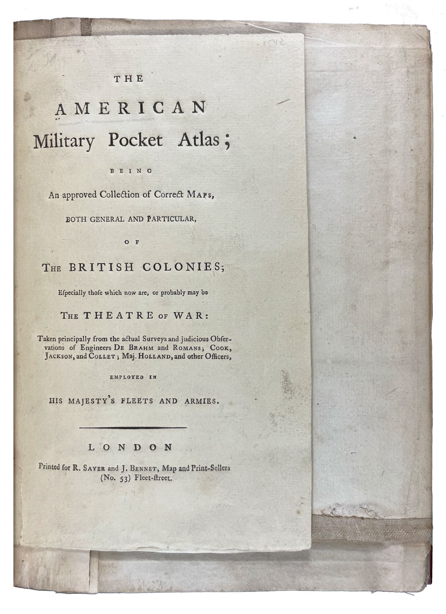
The American Military Pocket Atlas; being an approved collection of correct maps, both general and particular, of the British Colonies; especially those which now are, or probably may be the Theatre of War: Taken principally from the actual surveys and judicious observations of engineers De Brahm and Romans; Cook, Jackson, and Collett; Maj. Holland, and other officers
London: Printed for R. Sayer and J. Bennet, [1776]. Octavo. (10 5/8 x 8 1/4 inches). Letterpress text: title (verso blank), 2pp. dedication to 'Gov. Pownall', 2pp. 'Advertisement', 1p. 'List of maps' (verso blank). 6 folding engraved maps, all hand-coloured in outline, all dissected into sections as issued, hinged with linen and folded. (Triangle from upper outer corner of dedication leaf torn away without affecting the text).
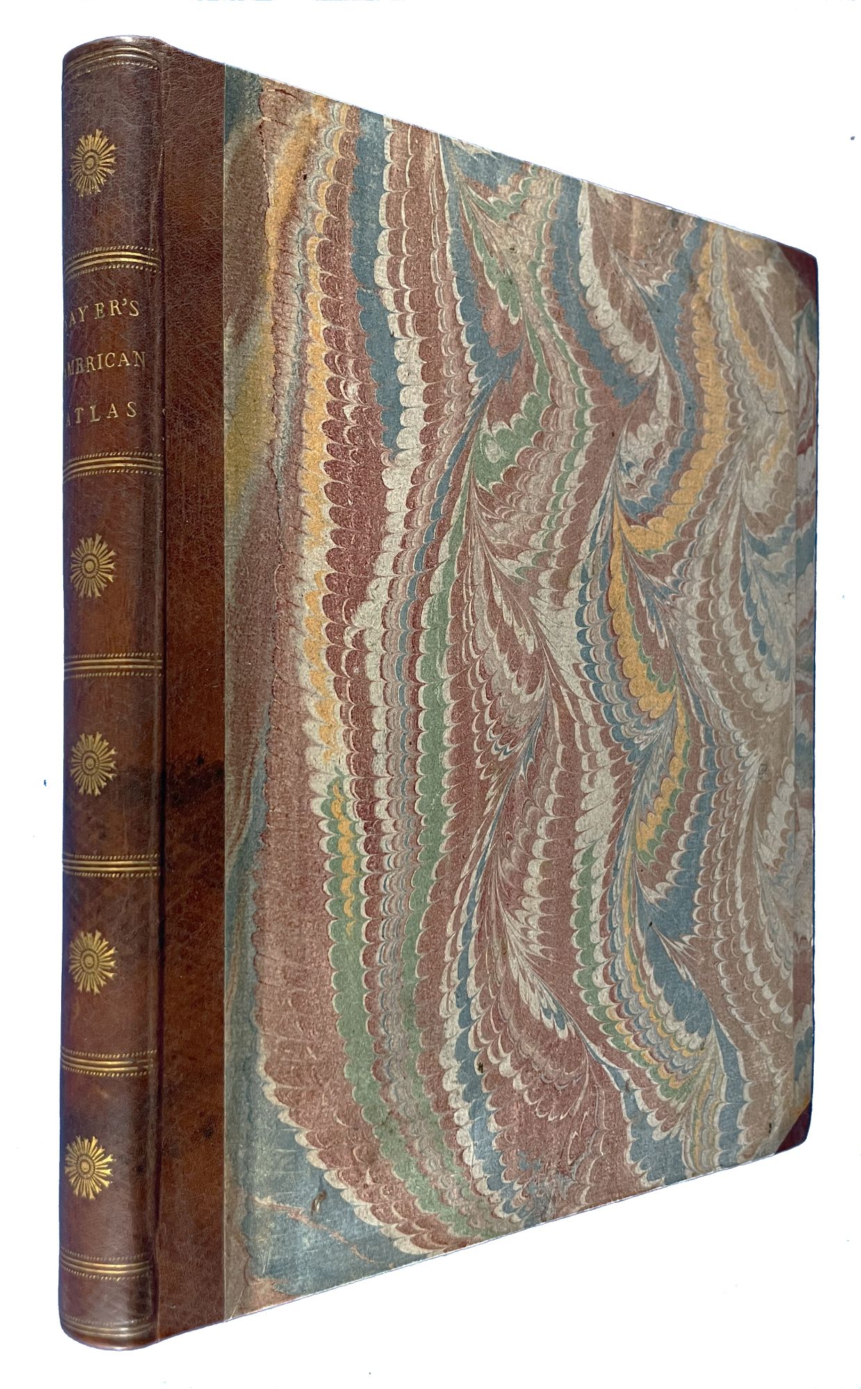
Expertly bound to style in 18th-century half russia over contemporary marbled paper-covered boards, spine ruled in gilt in compartments, lettered direct in the second compartment, the others with a repeat decoration in gilt
The Holster Atlas: one of the most important atlases of the American Revolution designed for use in the field. The Holster Atlas was issued at the suggestion of Governor George Pownall and included the "maps that the British high command regarded as providing essential topographical information in the most convenient form" (Schwartz & Ehrenberg).
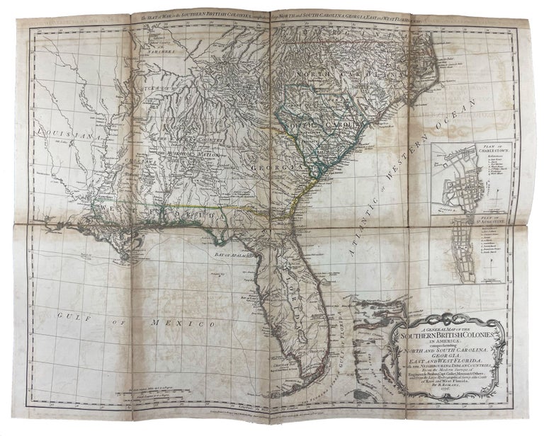
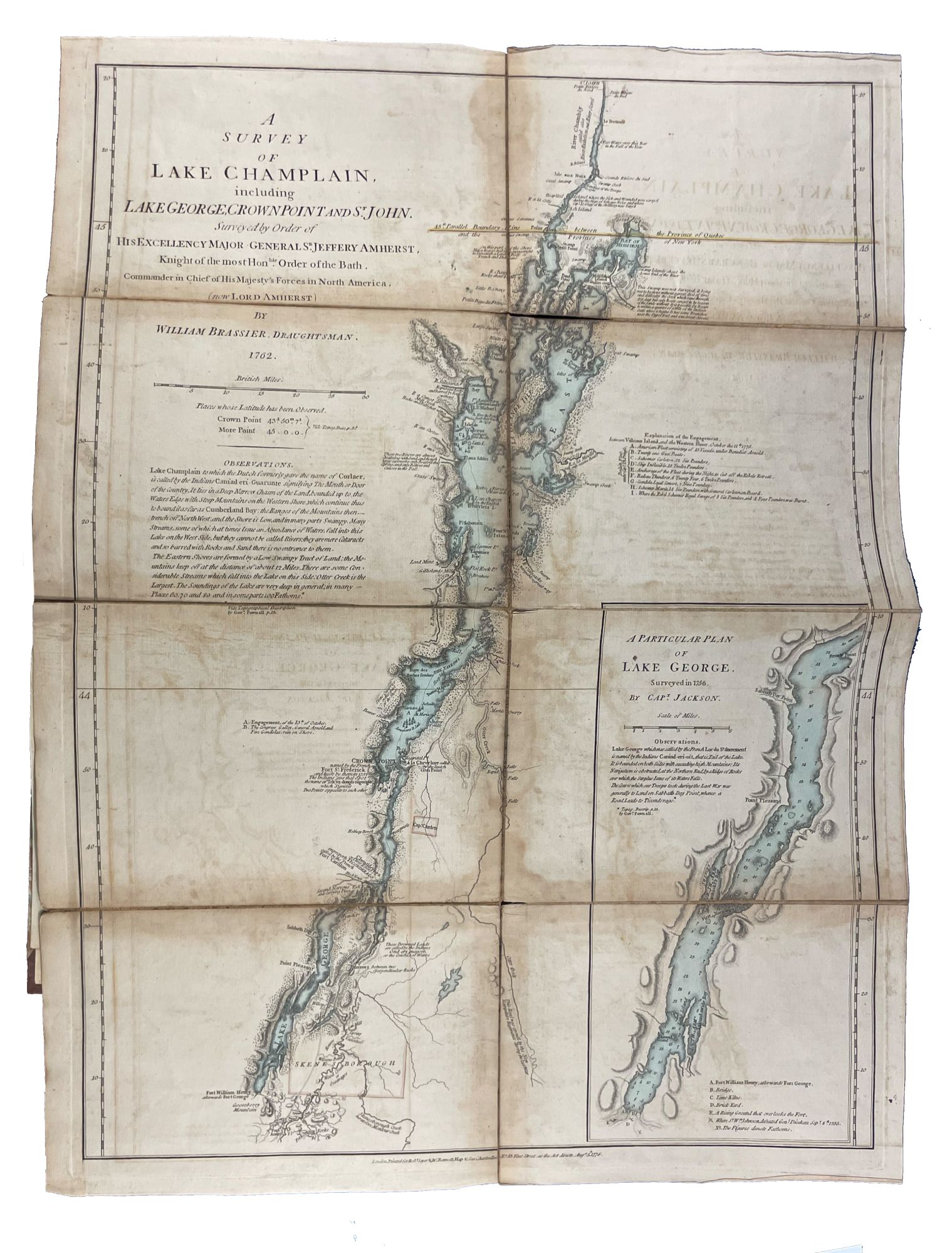
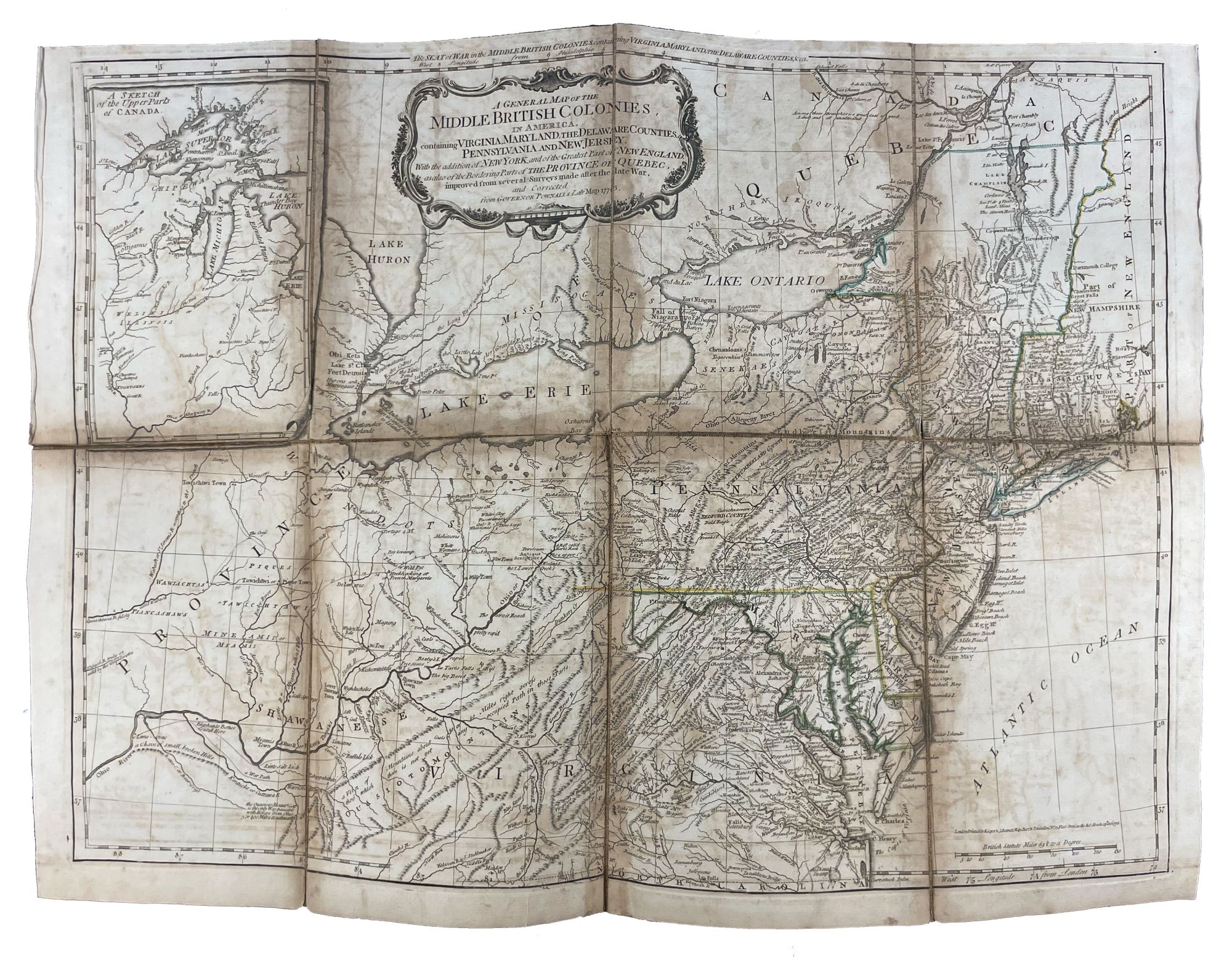
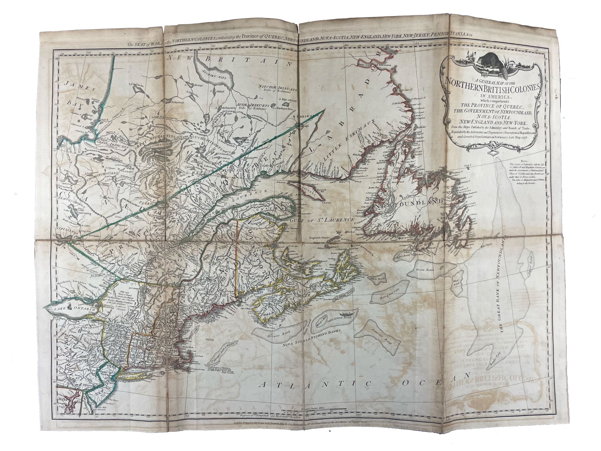
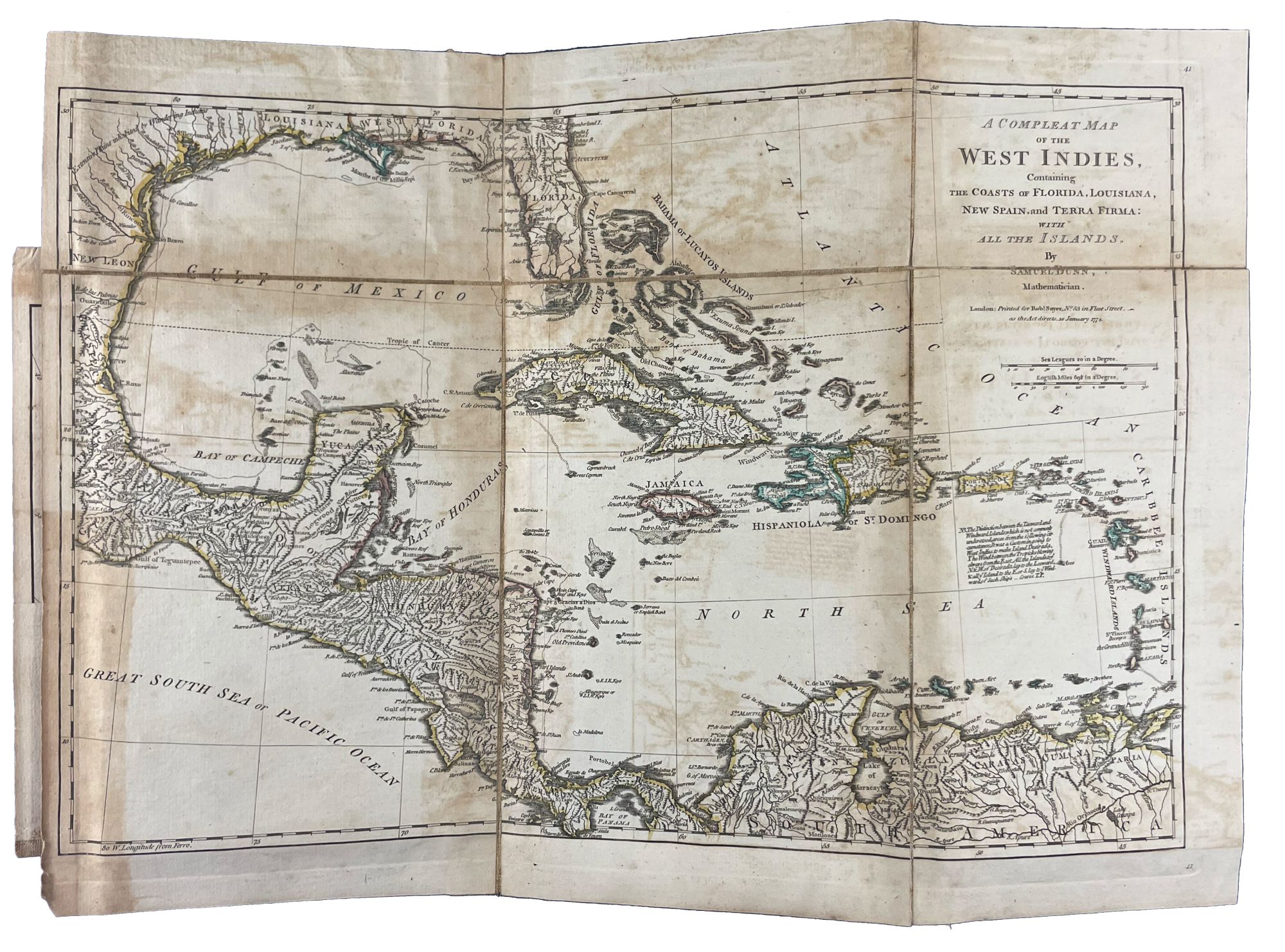
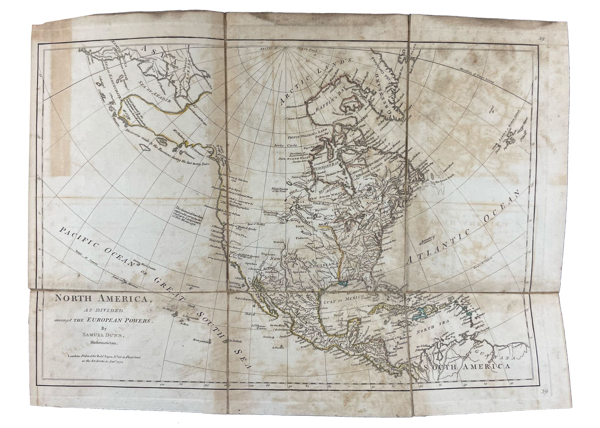
This collection of maps was published by Sayer and Bennet at the beginning of the Revolution for the use of British officers. "Surveys and Topographical Charts being fit only for a Library, such maps as an Officer may take with him into the Field have been much wanted. The following Collection forms a Portable Atlas of North America, calculated in its Bulk and Price to suit the Pockets of Officers of all Ranks" (Advertisement). Although the publishers claimed the atlas would fit into an officer's pocket, it was more usually carried in a holster and thus gained its nick-name. The six maps are as follows: 1. DUNN, Samuel. 'North America, as divided amongst the European Powers. By Samuel Dunn, Mathematician London: printed for Robt. Sayer, 10 Jany. 1774.' Engraved map, hand-coloured in outline, in six unequal sections (sheet size: 13 3/4 x 19 inches). Engraved for Dunn's 'A New Atlas' (London: 1774). 2. DUNN, Samuel. 'A compleat map of the West Indies, containing the coasts of Florida, Louisiana, New Spain, and Terra Firma: with all the islands.' London: Robt. Sayer, 10 January 1774. Engraved map, hand-coloured in outline, in six unequal sections (sheet size: 13 1/8 x 19 inches). Engraved for Dunn's 'A New Atlas' (London: 1774). The 'Advertisement' describes these first two maps as 'a general map of the part of the globe, called North America, and a second general map of those islands, shores, gulfs, and bays, which form what is commonly called the West Indies; these we consider as introductory, and as giving a general idea, and we trust a just one.' 3. 'A general map of the Northern British Colonies in America. which comprehends the Province of Quebec, the Government of Newfoundland, Nova-Scotia, New-England and New-York. from the maps published by the Admiralty and Board of Trade, Regulated by the astronomic and trigonometric observations of Major Holland and corrected from Governor Pownall's late Map 1776. London: Robt. Sayer & Jno. Bennet, 14 August 1776.' Engraved map, hand-coloured in outline, in eight unequal sections (sheet size: 20 1/2 x 27 1/2 inches). First state, also issued as a separate map. This map was re-issued in 1788 with the title changed to reflect the new political realities. McCorkle New England 776.11; Sellers & Van Ee 143; Stevens & Tree 65 4. EVANS, Lewis. 'A general map of the Middle British Colonies, in America. containing Virginia, Maryland, the Delaware Counties, Pennsylvania and New Jersey. With the addition of New York, and the greatest part of New England, as also of the bordering parts of the Province of Quebec, improved from several surveys made after the late war, and corrected from Governor Pownall's late Map 1776. London: R. Sayer & J. Bennet, 15 October 1776.' Engraved map, hand-coloured in outline, in eight unequal sections (sheet size: 20 1/4 x 27 3/4 inches). Based on Lewis Evans' map of 1755, with additions and corrections. Cf. Stephenson & McKee Virginia p.82 (an image of the Evans map) 5. ROMANS, Bernard. 'A general map of the Southern British Colonies, in America. comprehending North and South Carolina, Georgia, East and West Florida, with the neighbouring Indian countries. From the modern surveys of Engineer de Brahm, Capt. Collet, Mouzon & others; and from the large hydrographical survey of the coasts of East and West Florida. By B. Romans. London: R.Sayer & J. Bennett [sic.], 15 Octr. 1776.' Engraved map, hand-coloured in outline, eight unequal sections (sheet size: 20 3/4 x 27 inches). Based on charts and maps by Roman and others. 6. BRASSIER, William Furness (1745-1772). 'A Survey of Lake Champlain including Lake George, Crown Point and St. John, Surveyed by order of ... Sr. Jeffery Amherst ... by William Brassier, draughtsman. 1762. London: Robt. Sayer & Jno. Bennet, 5 Aug., 1776.' Engraved map, hand-coloured in outline, on eight unequal panels (27 3/4 x 20 3/8 inches). Also issued as the first separately published map of Lake Champlain, this excellent detailed chart was based on a survey made during the French and Indian War, but not published until the Revolution. Included is an inset illustrating America's first naval battle, in which General Benedict Arnold, though forced back down the lake, was able to delay the British attempt to descend to the Hudson for that year. No mention, of course, is made of Ethan Allen's taking of Fort Ticonderoga in 1775.
Fite & Freeman A Book of Old Maps pp.212-216; Howes A208; Nebenzahl Atlas of the American Revolution pp.61-63; Phillips Atlases 1206; Rumsey p.311; Sabin 1147; Schwartz & Ehrenberg p.190; Streeter Sale 73.
Item #23542
Price: $16,500.00