
BRADFORD, Thomas Gamaliel (1802-1887)
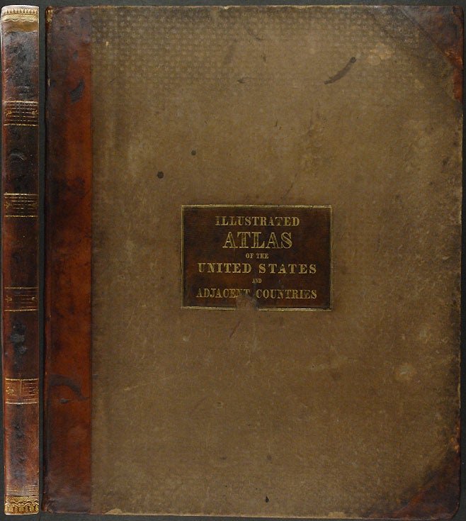
An Illustrated Atlas, Geographical Statistical, and Historical, of the United States, and the adjacent countries
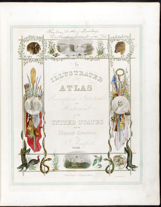
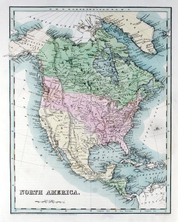
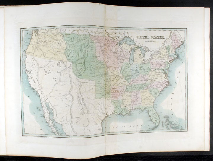
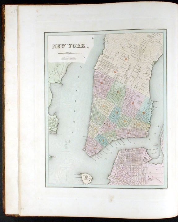
Boston & Cincinnati: stereotyped and printed by Fulsom, Wells & Thurston of Cambridge, Mass. for Weeks, Jordan & Co. of Boston and Edward Lucas & Co. of Cincinnati, [1838]. Folio. (19 1/2 x 15 3/4 inches). Engraved additional title with integral hand-coloured decorative pictorial surround, 39 hand-coloured engraved maps and town-plans (34 maps [one double-page], 5 town-plans), by G.W.Boynton and others.
Contemporary light brown half morocco over embossed cloth-covered boards, brown morocco title label on the upper cover, lettered in gilt, the spine divided into five compartments by wide semi-raised bands, the bands highlighted with gilt tooling, marbled endpapers
Provenance: Theodore Sutton Parvin (1817-1901, Burlington, Iowa, inscription dated 15 August 1838 on additional title)
A fine copy of "one of the first American general atlases to supplement the maps with lengthy geographical descriptions" (Ristow), with detailed maps of the 28 States, and including an excellent early map of the Republic of Texas.
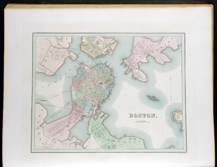
Martin and Martin, in their entry on Bradford's 1835 map of Texas, also note that "Bradford published a completely new atlas in 1838, in a larger format, and the map of Texas it contained was even more clearly patterned on [Stephen Fuller] Austin's [Map of Texas, published in Philadelphia in 1830]." It was one of the first maps of Texas as a Republic to appear in an atlas. The atlas is made up of a general map of North America, two maps of Canada, a folding map of the United States, 28 maps of States, a map of the Republic of Texas, a map of the islands of the Caribbean and five town-plans of eight U.S. cities (Washington, New Orleans, Louisville and Cincinnati on one sheet, and single sheet plans of Boston, New York, Philadelphia and Baltimore). Unlike many atlases of the period, the present work includes extensive text (170pp. in total). Each engraving is accompanied by explanatory articles on the history, economics and geography of the area, as well as a great deal of contemporary statistical information. The provenance is particularly interesting: Theodore Sutton Parvin was born in Cedarville, Cumberland County, N. J., on January 15, 1817; and died June 28, 1901. "He was graduated at Woodward College, Cincinnati, in 1836; he studied law; was private secretary of the first governor of Iowa Territory, Robert Lucas, in 1838, and was the first librarian of that territory. Later he was librarian and professor in the Iowa State University; was a founder of the Iowa State Historical Society in 1857, and for the years 1863-65 was its corresponding secretary and editor. He was the founder, in 1844, of the Iowa Masonic Library, and through his exertions this library has its present building at Cedar Rapids. From its foundation until his death, fifty-seven years, he was its librarian" (Collections of the Minnesota Historical Society, [1905]. vol.X, part II, p.871).
Le Gear L33; cf. Martin & Martin p.125; cf. Phillips Atlases 138; Howes B701; Ristow p.271; Sabin 7261.
Item #23932
Price: $12,000.00