
HUNTER, B. J.
Map of Oswego County, New York, from actual surveys under the direction of Samuel Geil ... by B.J. Hunter
Philadelphia: Gillett, Matthews, [copyright date: 1854]. Engraved map, full original hand-colouring, folding in 36 sections, backed onto linen at a contemporary date, edged with green silk ribbon. Sheet size: (51 3/4 x 57 inches).
A fine copy with beautiful colouring of this important large-scale map of Oswego County, New York.
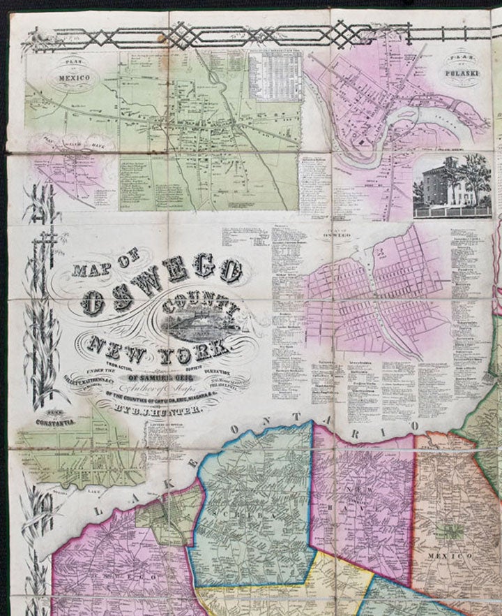
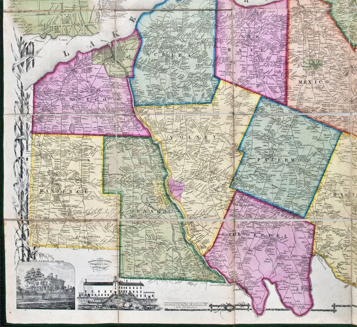
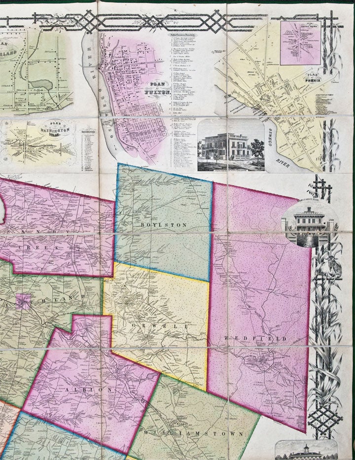
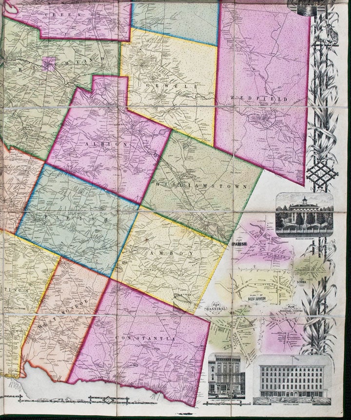
Established in 1816, Oswego County occupies 968 square miles of land on the southeastern shore of Lake Ontario. The present handsome map was the largest and best of Oswego in the nineteenth century. Each township is individually coloured, with every rural property owner located and identified by name. The map includes fifteen integral town plans (some flanked by listings of local businesses) and eight vignette views. The town plans are for the following: Constantia, Mexico, Sand Bank, Pulaski, Oswego, Cleveland, Washingtonville, Fulton, Central Square, Phoenix, Parish, Scriba, New Haven, Hannibal and Hannibal Centre. It is interesting to note that although the map is constructed by Hunter from surveys produced by Geil, it was registered for copyright (in 1854) by Robert Pearsall Smith. Beginning in 1853, Pearsall Smith had contracted with a number of local surveyors to construct maps of New York counties: this was evidently one of those maps. The map is here presented as a case map, sectioned and linen-backed at a contemporary date, rather than in wall map form, thus preserving the beauty of the original colouring, and without the varnish that tends to be such an unwelcome feature of wall maps of the period.
Ristow American Maps & Mapmakers p.392.; not in Rumsey.
Item #24769
Price: $2,250.00