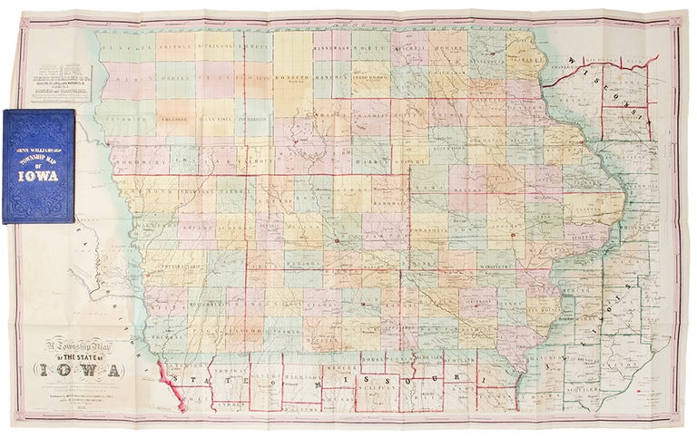

IOWA - HENN, WILLIAMS & Co. and R. BARNES (publishers)
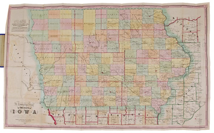
A Township Map of the State of Iowa Compiled from the United States Surveys, official information and personal reconnaissance, showing the streams, roads, towns, post offices, county seats, works of internal improvement, &c., &c
Fairfield, Iowa and Philadelphia: Henn, Williams & Co. and R. Barnes, 1855. Folding pocket map lithographed by Friend & Aub of Philadelphia, full original period hand colouring. Folds into original blue cloth covers, blocked in blind, the upper cover with publisher and title in gilt. Sheet size: 21 1/8 x 34 1/4 inches.
A fine copy of this attractive map of Iowa from the early years of its settlement, this second edition shows the rapid development within the state and is the first edition to include Sioux City and many proposed railroad routes.
This large and colourful map of Iowa shows the state divided into numerous counties, all within nine land districts, with the sites of the land offices identified in each. Issued to promote settlement in the state, the map includes an advertisement in the upper left corner for Henn, Williams and Co.: "dealers in land, land warrants & exchange ... special attention given to Location of Land, the sale and loan of Warrants and to the collecting & remitting of sight and time bills. Investments made in any part of Iowa." Besides locating numerous towns and river systems, the state's burgeoning railroad system is shown, with many proposed routes depicted across the state by means of dotted lines. This is the second edition of the map, after the first of 1854, but apparently printed from a new plate to incorporate the rapid growth. A third edition followed in 1856.
Phillips A List of Maps of America, p. 337; Rumsey 1739; Graff 1857; Streeter sale 3898.
Item #24811
Price: $600.00