
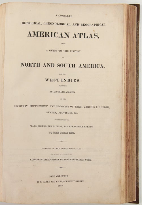
CAREY, Henry Charles, and Isaac LEA (publishers)
A Complete Historical, Chronological, and Geographical American Atlas, being a guide to the history of North and South America, and the West Indies: exhibiting an accurate account of the discovery, settlement, and progress, of their various kingdoms, states, provinces, &c. Together with the wars, celebrated battles, and remarkable events, to the year 1822
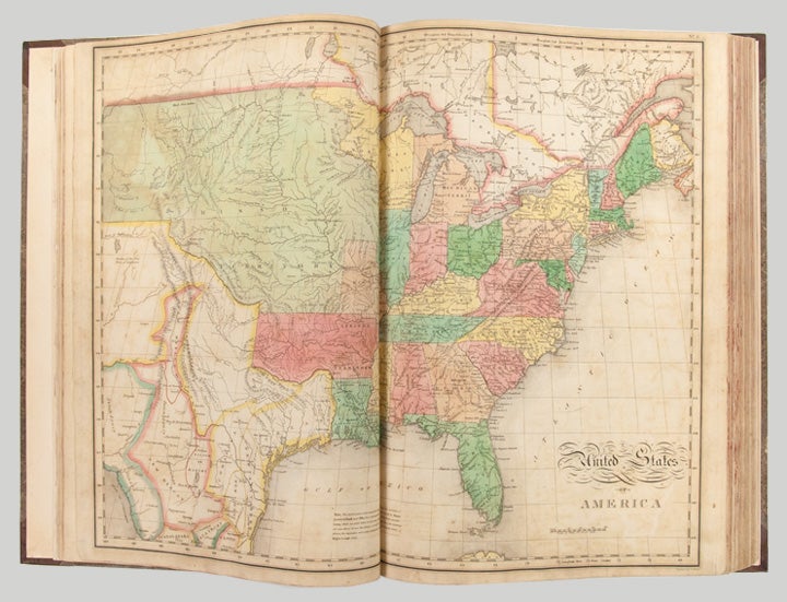
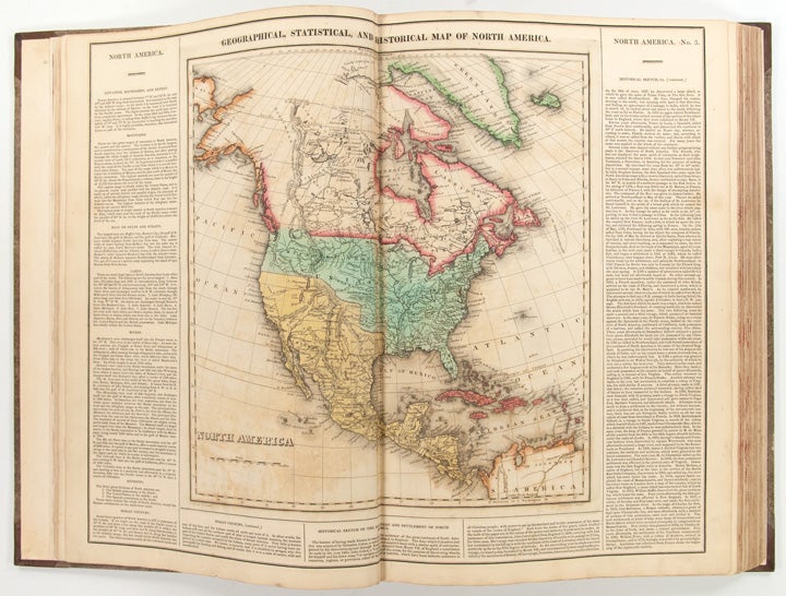
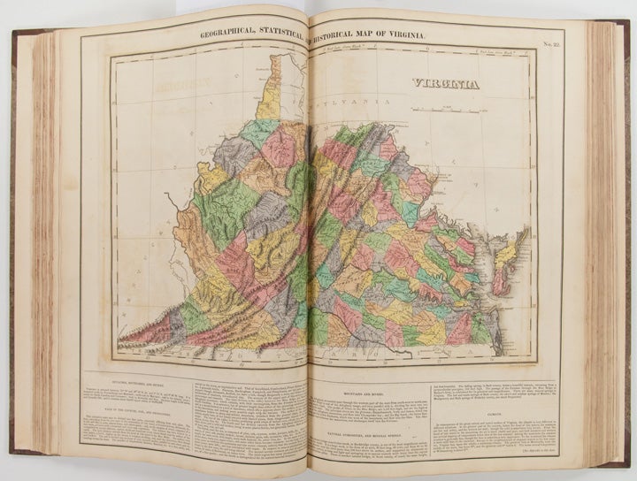
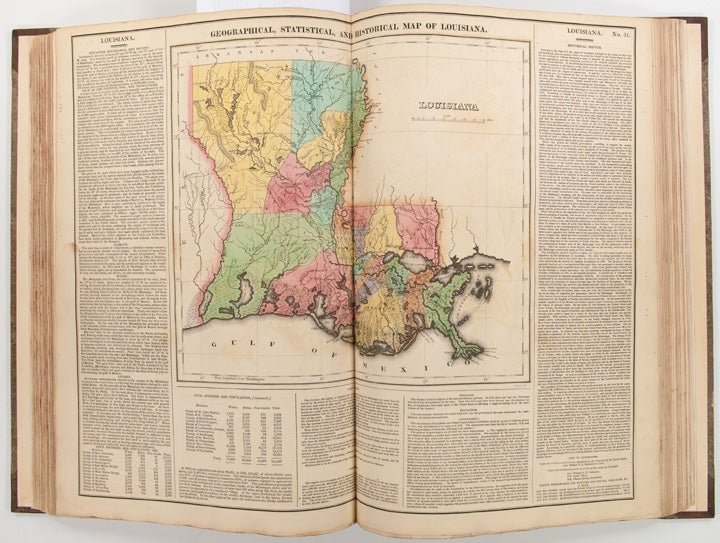
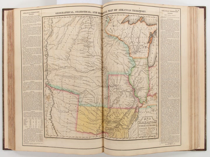
Philadelphia: H.C. Carey & I. Lea, 1823. Folio. (17 1/2 x 11 7/8 inches). Mounted on guards throughout, letterpress title (copyright notice on verso), 1p. Advertisement (verso blank), 1p. Contents (verso blank), 46 double-page hand-coloured engraved maps of the United States, all but one with borders of letterpress descriptive text, 1 uncoloured double-page engraved view showing the comparative heights of mountains throughout the world, 1 hand-coloured double-page engraved table showing the comparative lengths of the principal rivers worldwide, 5 letterpress tables (4 double-page [3 of these hand-coloured]), 18pp. of letterpress text.
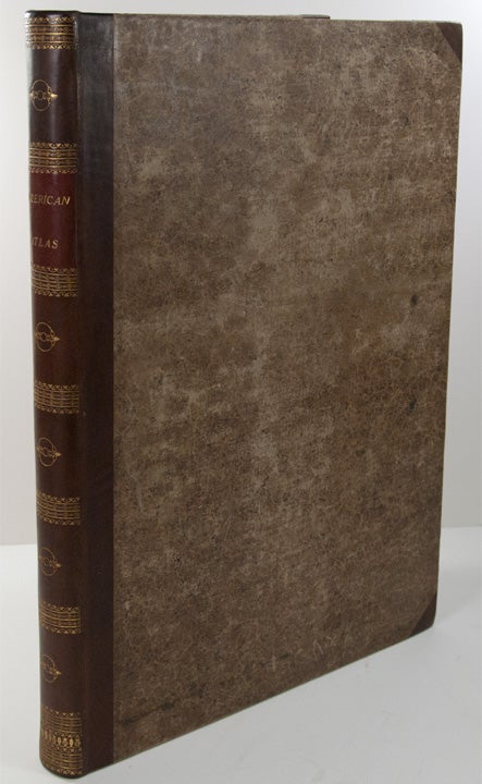
Expertly bound to style in half calf over contemporary marbled paper covered boards, flat spine in six compartments divided by gilt roll tools, red morocco label in the second compartment, the others with a repeat decoration in gilt.
One of the most important early atlases printed in the United States: a handsome atlas of the Americas, with individual colour maps of each state in the Union, including a seminal map of the West by Stephen H. Long.
At the time of publication this was the best and most detailed atlas to be produced in the United States. Fielding Lucas, the major Baltimore printer, was the principal engraver and substantial historical background text accompanies each map. Among the most noted maps in the atlas is Major Stephen H. Long's "Map of Arkansa and other Territories of the United States." That map, which depicts the Missouri basin between Nashville in the east, the Mandan villages in the north and the Rocky Mountains in the west, was based on the surveys conducted by Long on his expeditions of 1819 and 1820. The map published in Carey & Lea's atlas preceded the official account of that expedition by expedition botanist Edwin James, which included a smaller map with similar detail (titled "Country drained by the Mississippi Western Section"). Carey and Lea's 1823 publication of James Account perhaps explains the prior inclusion of this map with Long expedition information in their atlas. On this famous map is the printed legend, which would perpetuate a myth for many years to come, identifying the high plains as the "Great American Desert." Carey and Lea's atlas was first issued in 1822; this is the 1823 second issue, substantially the same as the first but with a new title and revised states of several maps and text leaves (generally minor revisions, including additional shading to maps and improved resetting of several text leaves, though this copy with first state settings of the Maryland and Virginia text leaves).
Howes C133 ("aa"); Phillips 1373a; Sabin 15055; Wheat, Transmississippi West 348 and 352; Phillips 'Atlases' 4464.
Item #25085
Price: $11,000.00