
D'ANVILLE, Jean Baptiste Bourguignon (1697-1782)
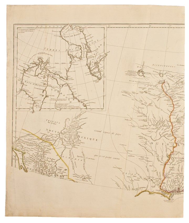
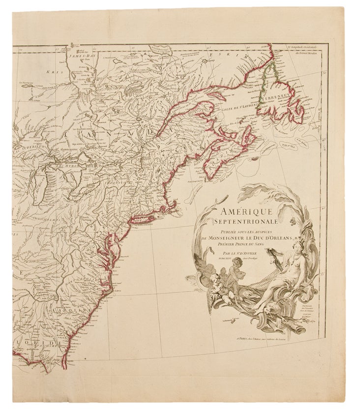
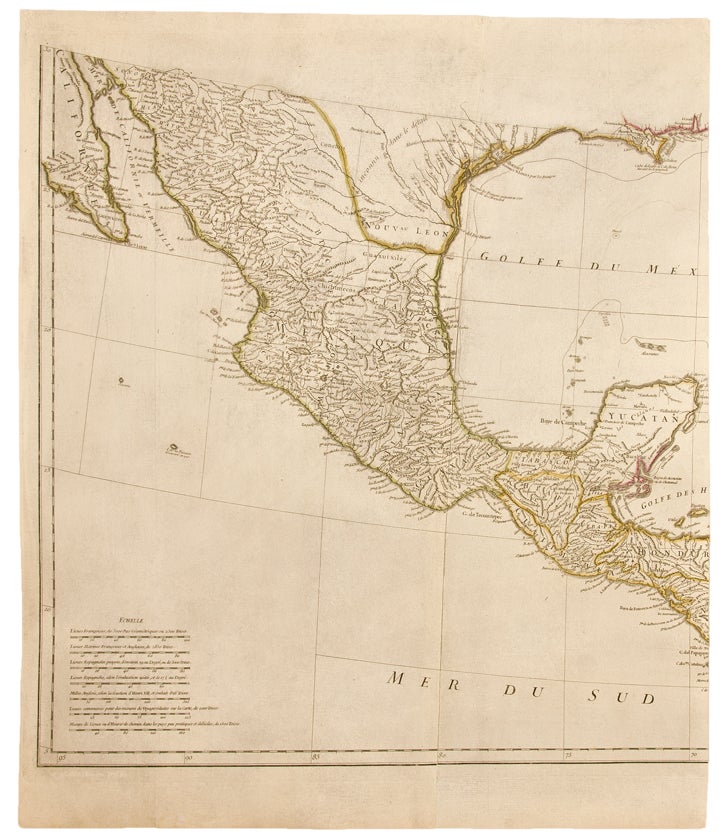
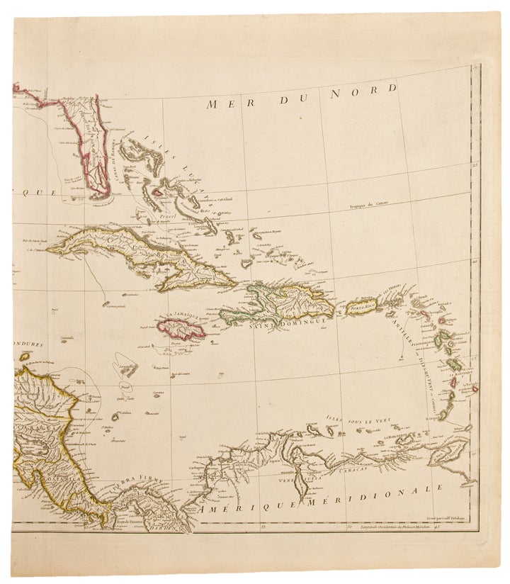
Amerique Septentrionale
Paris: 1746. Copper engraved map, on four unjoined sheets, period hand-colouring in outline. Sheet size: Approximately 41 x 36 inches, if joined.
One of the best French Maps of North America prior to the French & Indian War.
"To illustrate the cartography of the second half of the eighteenth century, a d'Anville map is essential. He dominated not only French but all contemporary geographers. He was one of the foremost to leave blank spaces in his maps where knowledge was insufficient" (Tooley). Jean Baptiste Bouguignon d'Anville was appointed Royal Geographer to Louis XV at the age of twenty. A meticulous scholar of cartographic sources, he drew on more than fifty years of French exploration of the region to draft this map. Cavalier de La Salle was the first explorer to travel down the Mississippi to the Gulf in 1682, claiming the region for France. The Sieur d'Iberville founded New Orleans in 1717, and by the time this map was drafted, the French had heavily explored the region. As shown here, they had at various times established a series of forts at Natchez, Mobile, Biloxi, and various missions in the upper Mississippi valley. The Spanish settlement of Pensacola as well as numerous native villages are also depicted. As evinced here, the French had not only surveyed the Gulf coast but also the interior, as the courses of many rivers, such as the Red, Ouachita, Pearl, Pascagoula, and Alabama, Arkansas, Illinois, and Missouri Rivers are clearly delineated. Also of note on this map is an excellent depiction of the Great Lakes (considered cartographically superior to the mapping by Mitchell) and the Ohio River Valley, as well as the inclusion of the newly formed colony of Georgia. "Jean-Baptiste Bourguignon d'Anville engraved his first map at age fifteen. He carried on the French school of cartography developed by the Sanson and the Delisle families and enjoyed a reputation as the finest mapmaker of his time. Although he apparently never left the city of Paris, he had access to the reports and maps of French explorers, traders, and missionaries. D'Anvilles American maps draw on material gathered from several French expeditions made during the first half of the eighteenth century. At this time, the French were intent on preempting Spanish expansion into the Mississippi River valley and finding trade routes to the western Indians and Santa Fe. DAnvilles maps significantly improved the geographic knowledge of the Mississippi and Missouri river regions" (Lewis & Clark: the Maps of Exploration, University of Virginia Library, online exhibition). This map would have a lasting impact with Thomas Jeffery's using it as the basis for his own map of North America in 1755. Furthermore, d'Anville's 1746 map was among the maps consulted by Nicholas King for his seminal manuscript map of the western parts of North America done for use on the Lewis & Clark expedition.
Phillips, A List of Maps of America, p. 571; Tooley, pp. 316-371; Lowery 381; The Literature of the Lewis & Clark Expedition, p. 40; Karpinski, Bibliography of the Printed Maps of Michigan p. 138.
Item #25792
Price: $1,200.00