
WILLIAMS, C. S.
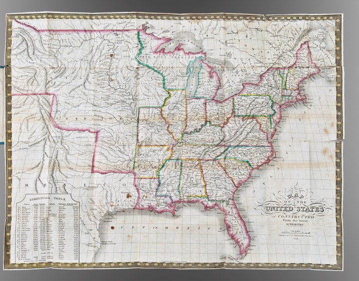
Map of the United States constructed from the latest authorities
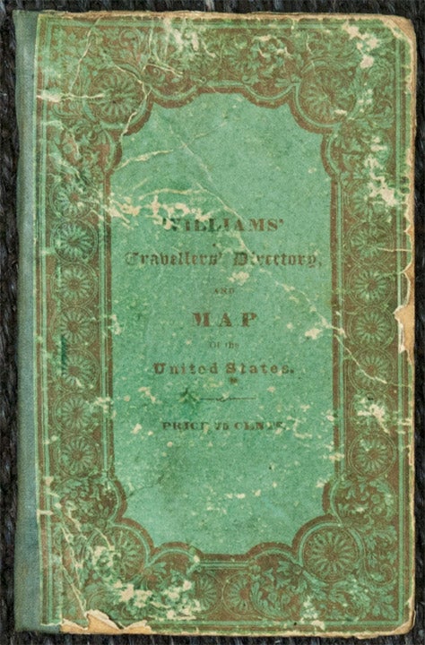
New York: C.S. Williams, 1833. Engraved folding pocket map, period hand-colouring in outline, statistical table in lower left corner. Folding index sheet. Folds into publisher's cloth-backed paper boards, titled on upper cover "Williams' Travellers' Directory...". (Boards worn, some repaired separations at folds). Sheet size: 16 3/8 x 21 5/8 inches.
Scarce map depicting the U.S. as far west as the Rockies.
This small "Travellers Directory" (as it is titled on the upper cover) was evidently issued in competition to Mitchell's similar guide of the same year. The two guides are quite similar in terms of format (folding sheets of tables facing a folding map), but the map in the present guide extends significantly farther west, i.e. to present-day Arizona in the southwest (with the Gila River named) and present-day Idaho in the northwest (with Lake Wayton, i.e. Lake Coeur d'Alene, named). Longs and James Peaks are both named, as well as the apocryphal River Buenaventura. Texas is shown as Mexico, although is named as the area along the Gulf Coast of eastern Mexico from Galveston to the Sabine River. The map is generally similar in appearance to Melish's 1822 map of the U.S., but with significant differences in nomenclature. Williams would later jointly publish the maps of Texas and Mexico in Mitchell's New Universal Atlas of 1846.
Streeter Sale 3847. Not in Wheat, Mapping the Transmississippi West.
Item #25845
Price: $1,500.00