
IOWA - CHAPMAN, Silas (1813-1899)
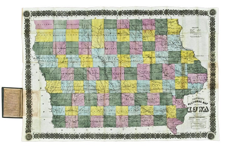
Chapman's Sectional Map of the State of Iowa Compiled from the United States Surveys and other authentic Sources
Milwaukee: Dyer & Pasmore, 1857 [lithographed by Ferdinand Mayer & Co., New York]. Folding pocket map, full period hand-colouring. Folds into publisher's blindstamped green cloth covers, title stamped in gilt on upper cover, publisher's ad on the front pastedown. Sheet size: 24 1/2 x 36 1/4 inches.
Lovely copy of Chapman's Iowa.
This large, early map of Iowa shows each county divided into ranges, with the state's principal towns and numerous rivers identified, as well as both completed and proposed railroad routes illustrated. A printed note in the lower right corner, signed in print by Surveyor General Warner Lewis, states that "this Map of the State of Iowa was projected by Major Jas. A. Reid from the original plats on file in this office, and that it has been carefully compared and is correct." Chapman's map was first published in 1856, with this second issue, published by Dyer & Pasmore, published the year following. Later editions were published in the 1860s.
Phillips, A List of Maps of America, p.337 (1856 edition).
Item #25849
Price: $600.00