
IOWA - COLTON, George W. (1827-1901)
G. W. Colton's Township Map of the State of Iowa
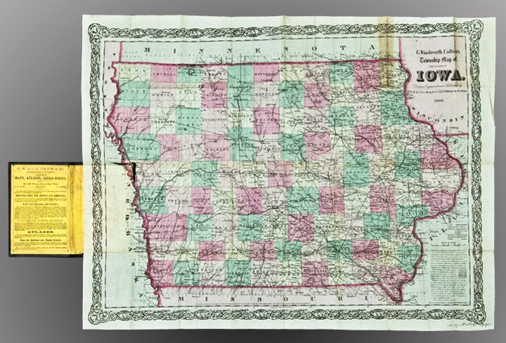
New York: G.W. & C.B. Colton, 1869. Folding pocket map, full period hand-colouring, ornamental border. Census table at lower right. Folds into publisher's blindstamped cloth covers, title stamped in gilt on the upper cover, Colton ad on the front pastedown. Sheet size: 18 1/2 x 24 inches.
Colton pocket map of Iowa.
Iowa experienced explosive growth during the 1860s, largely as a result of the rapid development of the state's railroad system. At the beginning of the decade, Iowa's few railroads were entirely confined to the eastern one-third of the state. By the time Colton published this fine map in 1869, several lines had pushed to its western border, including the Mississippi & Missouri Railroad, which joined the transcontinental railroad at Council Bluffs. This map is similar to another one published by the Coltons in the same period, though smaller and without the "sectional" divisions.
Rumsey 0180 (1855 issue); Phillips, A List of Maps of America, p. 337 (1862 issue).
Item #25853
Price: $500.00