[CIVIL WAR] - READ, Joseph Corson
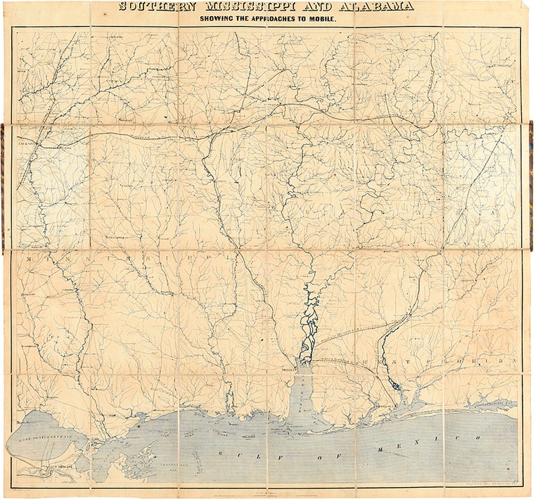
Southern Mississippi and Alabama Showing the Approaches to Mobile
[Washington]: Coastal Survey Office, 1863. Folding map, (24 x 25 1/2 inches), mounted in twenty-four sections on linen. Original card covers with printed paper label. Contemporary ownership inscription on label. Light wear. Minor foxing and wear to map.
Rare field operations map of Mississippi.
This rare Civil War map was created by the Coast Survey office, the main cartographic arm of the Union Army, for use in the Union campaigns into the South. This copy was owned and used by Colonel Joseph Corson Read, the Chief Commissary of the Army of the Cumberland. In November 1863, the Union armies captured Chattanooga, the "Gateway to the South," enabling them to stage a prolonged offensive into the Southern heartland. Grant moved very quickly to overwhelm the South and immediately ordered Sherman to move against Atlanta and its vital railroad supply lines, at the same time as he sent Nathaniel Banks to attack Mobile, Alabama. Joseph Corson Read (1831-1889) was one of the first wave of men to take up Abraham Lincoln's call for volunteers to put down the rebellion in April 1861. He remained continuously in the army, serving first on General Jesse Reno's staff and rising to the rank of Chief Commissary for the Army of the Cumberland, commanded by George H. Thomas. Thomas was impressed with Read, and on May 1, 1864, with the spring campaign against Atlanta imminent, Thomas named Read Chief Commissary of the Army of the Cumberland in the Field. This meant that, although Colonel A.P. Porter was the Army's overall chief, Read would serve alongside Thomas in the field and had the responsibility to supply the entire army as it moved South. During the long and arduous Atlanta campaign he was the man on the ground, making the supply side work. Read developed a close relationship with Thomas, one with both personal and professional aspects. This map, scaled at ten miles to the inch, shows Mississippi and Alabama from Jackson to Montgomery, starting about fifty miles north of those two points and continuing south to New Orleans and the Gulf of Mexico. Rivers, roads, and rail lines, and all the towns they connect, are detailed, with waterways printed in blue. Two of the railroads, the Mobile & Pensacola, and the Mobile & Great Northern, construction and removal dates during the war. An important map that would have been used by the Union Army in the field, specifically by the Chief Commissary of the Army of the Cumberland.
Library of Congress, Civil War Maps 260.1; Library of Congress, Railroad Maps 140.
Item #27010
Price: $5,500.00


