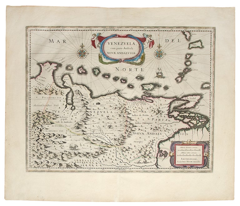

BLAEU, Willem (1571-1638) and Jan BLAEU (1596-1673)
Venezuela, cum parte Australi Nova Andalusiae
Amsterdam: 1640. Engraved map, period hand-colouring in outline. French text on verso. Sheet size: 19 5/8 x 23 1/4 inches.
A fine 17th century map of Venezuela and the Lesser Antilles.
In the seventeenth century, the Dutch hegemony in ship building and navigation engendered their dominance in mapmaking. At the lead of this field was the Blaeu family. Willem Janszoon Blaeu first studied mathematics and navigation under the famous astronomer Tycho Brahe in 1594, opening his own instrument and globe making shop in Amsterdam in 1599. Shortly thereafter, Willem Blaeu would open a printing house, specializing in works on navigation. The Blaeu family's first world atlas, modestly titled the Atlantis Appendix as it was considered a continuation of the atlases by Ortelius, Mercator and Hondius, was first published in 1630 by Willem Blaeu with his son Joan Blaeu, the official cartographers of the Dutch East India Company. The acclaim that Blaeu's atlases have always received is based primarily upon the extremely high production standards found within. The quality of the engraving and the paper are of the highest order, placing them in the first rank among seventeenth century illustrated books. Blaeu's maps and town plans are embellished in the Baroque style, and many rank among the most beautiful ever made.
Van der Krogt, (Atlantes) 9830:2.2; Koeman, Bl17.87.
Item #27611
Price: $480.00