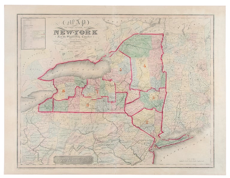

BURR, David (1803-1875)
Map of the State of New York and the Surrounding Country
Ithaca: Stone & Clark, 1841. Double-page engraved map, period hand colouring. Sheet size: 21 1/2 x 28 1/4 inches. Minor repair along lower centerfold.
A fine map from a rare edition of Burr's "Atlas of the State of New York": the first atlas devoted exclusively to New York State and an important milestone in the history of American cartography.
First published in 1829, Burr's atlas was financed by and under the auspices of the Legislature of the State of New York, and was drawn by Burr from the official surveys conducted by the Surveyor General's Office of the State. Burr's atlas was only the second atlas to be devoted to a single state, preceded only by Robert Mill's Atlas of South Carolina. The present general map of the state is from the rare third edition of 1841, published in Ithaca.
Item #27682
Price: $650.00