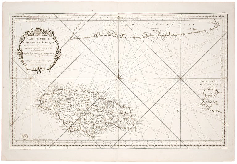

BELLIN, Jacques-Nicolas (1703-1772)
Carte Reduite de l'Isle de la Jamaique pour servir aux Vaisseaux Français
Paris: Imprimerie du Departement de la Marine, 1753 [but 1755-1766]. Engraved map. Sheet size: 25 1/2 x 37 1/4 inches.
Large detailed map of Jamaica and sea chart of the region from the Hydrographie Françcoise.
This detailed map of Jamaica, shown divided into parishes, includes strong topographical details with many coastal toponyms, as well as the coastlines of southern Cuba and western Haiti. Bellin, the official hydrographer to Louis XV, and master of the Dépot des Cartes et Plans de La Marine, had access to the most advanced cartographic resources available to the French state. The present map is one of his finest works, and was included as part of the L'Hydrographie Française, a great sea atlas, published by Bellin in two volumes from 1755 to 1766. The map was also sold separately, as indicated in the lower right corner of the map for a price of "Cinquante Sols." Bellin was so highly regarded that the British (who were almost always at war with France) made him a member of their Royal Society.
Kapp 66.
Item #27839
Price: $650.00