
COXE, Daniel (1673-1739)
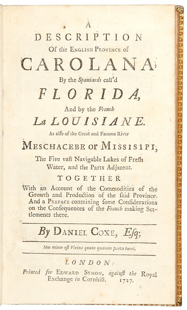
A Description of the English Province of Carolana, By the Spaniards call'd Florida, And by the French La Louisiane. As also of the Great and Famous River Meschacebe or Missisipi, The Five vast Navigable Lakes of Fresh Water, and the Parts Adjacent. Together With an Account of the Commodities of the Growth and Production of the said Province. And a Preface containing some Considerations on the Consequences of the French making Settlements there
London: Printed for Edward Symon, against the Royal Exchange in Cornhill, 1727. 8vo. (7 1/4 x 4 1/4 inches). [54], 122 pp. Fold-out copper-engraved "Map of Carolana and of the River Meschacebe" [i. e. Mississippi] (map linen-backed at an early date).
Later smooth tan calf by W. Pratt, covers with a gilt double filet border, spine with raised bands in six compartments, red Morocco lettering pieces in the second and third compartments, the others with a repeat decoration in gilt, marbled endpapers, gilt edge
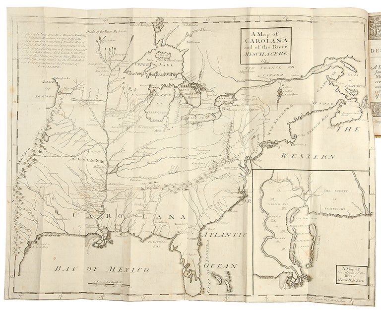
The first edition, third issue of this rare and highly important work, with the map which includes the first English depiction of the Mississippi Valley. It is the first published proposal of a political confederation of the North American colonies.
With the exception of the title, this third issue is identical to the first published in 1722. According to William S. Coker, in his introduction to the 1976 University of Florida facsimile of the first edition, the three subsequent "editions" were in fact re-issues of the unsold sheets of the first edition with new updated title pages inserted. This is one of the first English works to describe the American Southeast in any detail. Colonel Coxe laid claim to an enormous amount of land in the South thanks to grants made to his father Dr. Daniel Coxe by King Charles II. Coxe published the present work to further his family's claims, but also to raise awareness of the outsize potential of the area and the dangers posed by French incursions. He did not limit himself to the Carolinas, discussing the lower Mississippi in detail as well. Florida, Georgia, and Louisiana are also described. Much of the information, gathered from British hunters and explorers, is published here for the first time. The work is also credited with being the first published proposal of a political confederation of the North American colonies. The map, which is often missing, is a particularly fine copy: it is of real importance. Drawn up by the Coxe Family to illustrate their claims, it is also the first English depiction of the Mississippi Valley. It also improved on all previous maps by eliminating the mountain ranges that were often shown as running beside the Mississippi River, as well as correctly fixing the location of the Appalachian and Ozark Mountains. It extends as far north as the Great Lakes and includes an inset of the Mississippi Delta at the lower right: "A Map of the Mouth of the River Meschacebe."
Church 886; Clark I:68; Coxe, Description (Gainesville, Fl.: 1976); Cumming & De Vorsey 190; European Americana 741/48; Howes C826; JCB (1)III:679; Sabin 17281; Stevens 781; Vail 409.
Item #28339
Price: $11,000.00