
WARRE, General Sir Henry James (1819-1898)
Sketches in North America and the Oregon Territory. By Captain H. Warre, (A.D.C. to the late Commander of the Forces)
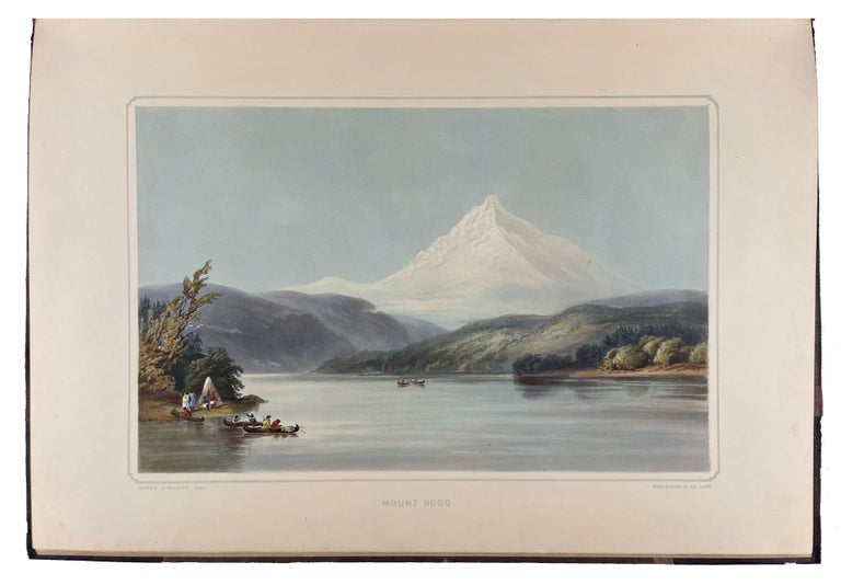
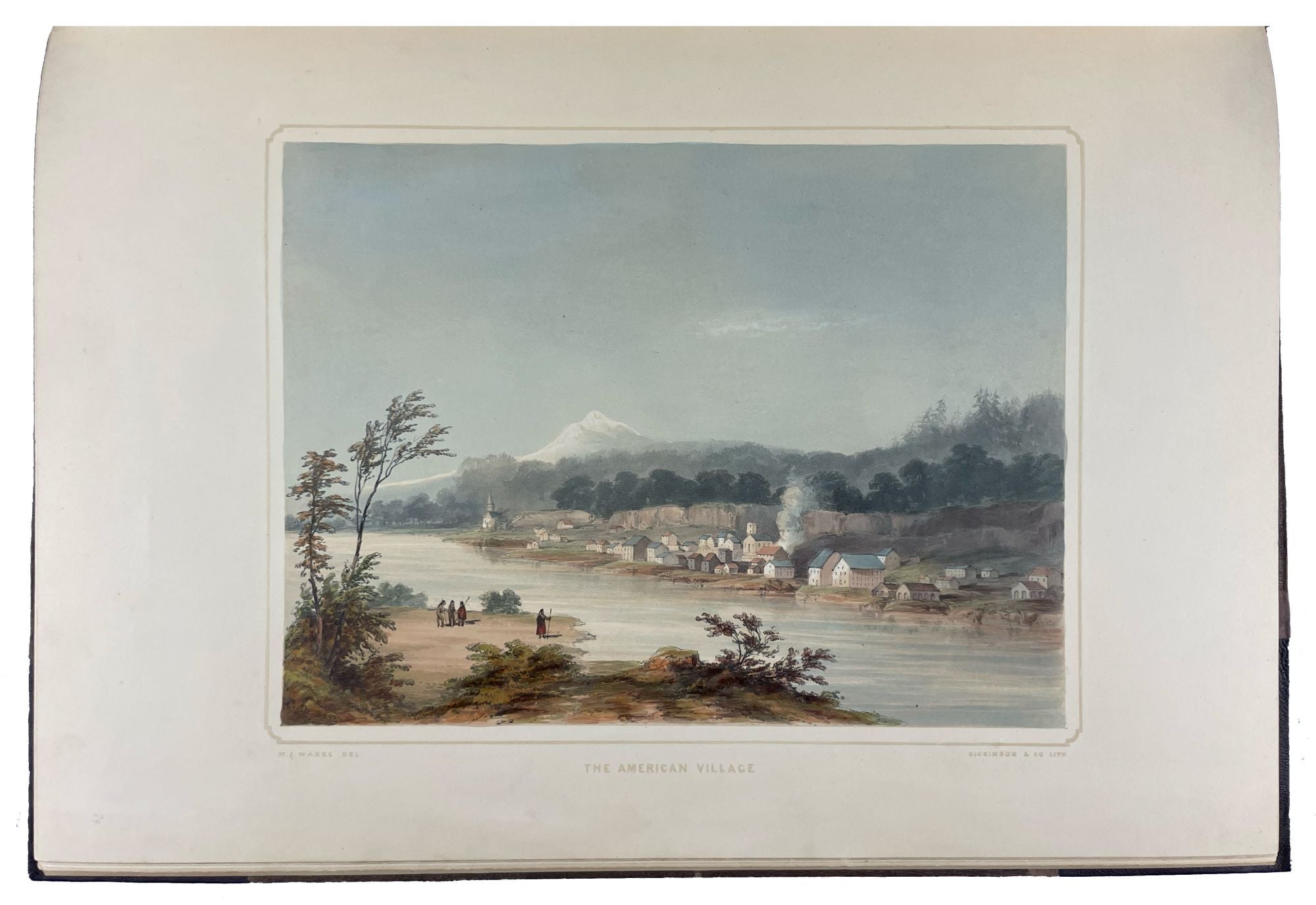
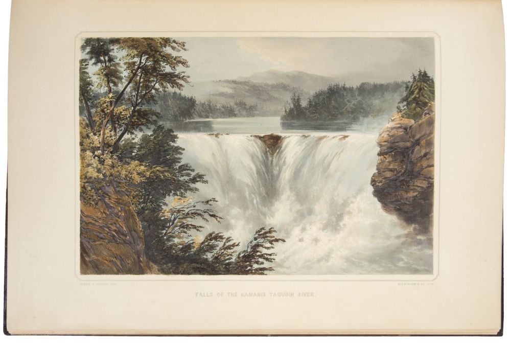
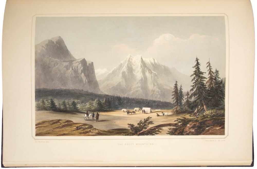
[London]: Dickinson & Co., [1848]. Folio. (21 x 14 1/4 inches). Letterpress title (verso blank), pp.[1-]5 letterpress text Sketch of the Journey. 20 hand-coloured lithographed views on 16 sheets, by Dickinson and Co., after Warre, 1 lithographic map, hand-coloured in outline with routes marked in red and blue. Very minor foxing to a few plates.
Contemporary purple cloth, rebacked and retipped with dark purple morocco, spine with raised bands in seven compartments, ruled in gilt and blind on either side of each band, lettered in gilt in the second compartment
Provenance: William Rathbone (booklabel); Lester E. Bauer (Parke-Bernet, 3 December 1958, lot 508); Frank T. Siebert (Sotheby's New York, 28 October 1999, lot 860)
First edition, original hand-coloured issue of a work which contains the "only western color plates comparable in beauty to those by Bodmer" (Howes). An important record of the American west before it was touched by western civilization.
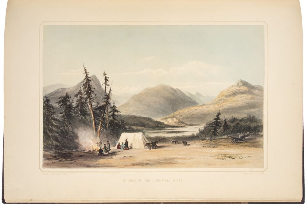
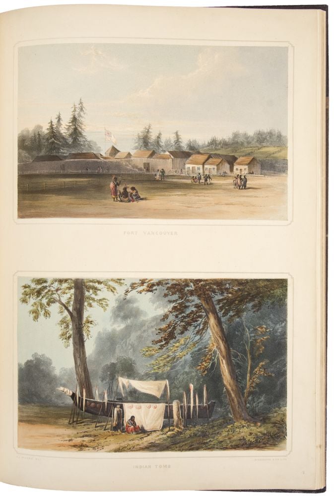
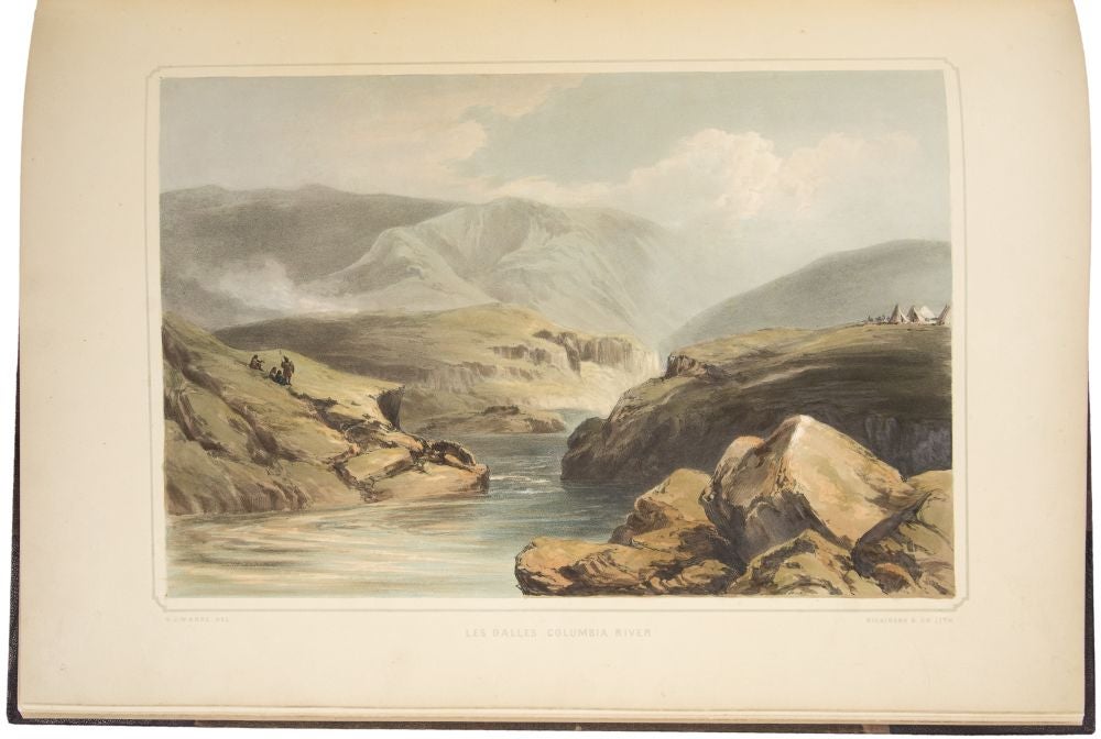
Captain Warre and Lieutenant Mervin Vavasour, of the Royal Engineers, left Montreal on 5 May 1845. They initially accompanied Sir George Simpson, governor of the Hudson's Bay Company, who was making a tour of inspection of the Company's outposts. On reaching Fort Garry (plate 1) at the confluence of the Red and Assiniboine Rivers, they teamed up with Peter Skene Ogden (1790-1854), a Company Chief Trader who had vast experience of the West, the Columbia and the Rockies in particular. Travelling mainly on horseback, the journey from the fort over the Rockies to Fort Colville took them from 16 June to 12 August. This section of the journey is illustrated by five plates. They left Fort Colville in boats and made their way down the Columbia River arriving at the Pacific on 25 August (3 plates). They then spent the winter exploring Oregon Territory and the Pacific Coast, visiting the Company settlement on the Willamette River (2 plates), exploring the Columbia River (1 plate), visiting Fort George on the Columbia River (2 plates), Vancouver Island and Fort Vancouver (1 plate), Cowelitz River and Puget's Sound. Once the weather started to improve, Warre and Vavasour and a party of about 30 began their westward journey on 25 March 1846, again by boat, but this time against the current. Warre made sketches of Mount Hood (2 plates) during this journey. They arrived at Fort Walla Walla, a distance of about 200 miles, on 3 April. They then took to horses again, and taking a short cut of about 250 miles, made for Fort Colville across a desert landscape (1 plate). From Fort Colville they went up the Columbia by boat for about 250 miles, setting off to cross the Rockies on foot. After seven days their food ran out, but, fortunately, a search party sent out from the Company station at Jasper's House found them and guided them to safety. The station was on the Atthabasca River, and from here they again took to boats and swiftly descended a distance of nearly 400 miles in two and half days to Fort Assinboine. On horseback, they travelled 100 miles in three days to Fort Edmonton on the Saskatchawan River. Then, by boat, 500 miles down the river to Fort Carlton. Again on horseback, they crossed the prairie to Red River in ten days, a distance of about 450 miles, arriving back at Fort Garry on 7 June. Here they met up with Sir George Simpson and together returned by boat to Montreal, arriving on 20 July 1846. The background to the journey was semi-official and semi-secret: Warre and Vavasour were to make what amounted to a military reconnaissance of the Oregon Territory. American expansionists were making it clear that the uneasy joint occupation of Oregon by the United States and Great Britain was not equitable and were demanding that a northernmost frontier be established. The two officers, with the enthusiastic support of the Hudson's Bay Company, were sent to gather information that would be of use in the negotiations. As Howes notes, Warre's dramatic depiction of the scenery, situations and incidents he encountered has resulted in "the only western color plates comparable in beauty to those by Bodmer." This copy without the dedication to the Hudson's Bay Company executives, which, as Howes notes was not issued in all copies. Warre continued with his military career after his return to Great Britain, serving with distinction in both the Crimean and the New Zealand Maori wars, he was knighted for his military services and retired with the rank of General. In addition to the present work he also published a series of views in the Crimea, published in London in 1856, but the present work is his undoubted masterpiece.
Abbey Travel II, 656; Graff 4543; Howes W-114; Sabin 101455; Smith 10727; Wagner-Camp 157.
Item #34798
Price: $100,000.00