

SCHULTZ, Christian
Travels on an Inland Voyage through the States of New-York, Pennsylvania, Virginia, Ohio, Kentucky and Tennessee, and through the territories of Indiana, Louisiana, Mississippi and New-Orleans; performed in the years 1807 and 1808
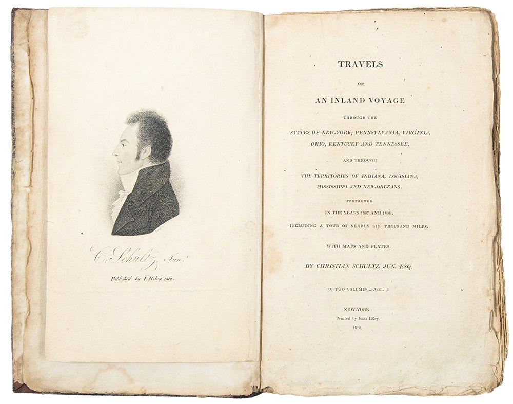
New York: Isaac Riley, 1810. 2 volumes, octavo. Engraved frontispiece portrait of Schultz by Leney, 7 engraved maps and plates (5 folding). Old repairs at folds of the maps.
Contemporary half calf and marbled paper covered boards, flat spine tooled in gilt, expert repairs to vol. 1. joints. Green cloth folding box.
Provenance: Frank T. Siebert (his sale, Sotheby's 21 May 1999, lot 343)
Siebert's copy, complete with all maps and plates, of an important early American travel account down the Mississippi.
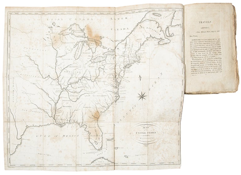
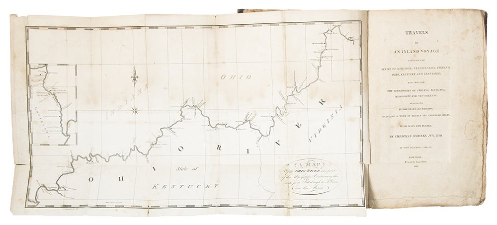
This epistolary narrative provides among the earliest detailed accounts of westward migration and on travel through Mississippi Territory and to Louisiana, with travel times, distances and potential dangers en route. The author's route took him from New York to the Great Lakes, through Ohio, and down the Mississippi to Louisiana, and back. Howes calls the work the "best description of this region at the period." This example complete with all maps and plates, as well as the portrait frontispiece. Copies are rarely found complete, usually lacking the portrait or the general map of the United States (both present here), the latter believed not to have been issued in all copies. The maps and plates comprise: 1) Map of the United States including Louisiana. Engraved by Scoles. Vol. 1, facing p. 1. 2) View of the boats navigating the Mohawk River. Engraved by Maverick. Vol. 1, facing p. 7. 3) A Map of the Hudson and Mohawk Rivers. Engraved by Maverick. Vol. 1, facing p. 128. 4) A Plan of the Ruins of the Ancient Fortifications at Marietta. Engraved by Maverick. Vol. 1, facing p. 146. 5) A Map of the Ohio River and part of the Mississippi. Engraved by Maverick. Vol. 2, facing the title. 6) A Map of the Mississippi River. Engraved by Maverick. Vol. 2, facing p. 113. 7) A Section of the Channel and Banks of the Mississippi River. Vol. 2, facing p. 211.
American Imprints 21289; Buck, Illinois 70; Clark, Old South 2:166; Graff 3707; Howes S202; Sabin 78001; Thomson, Ohio 1027.
Item #35082
Price: $7,500.00