


ROE, Frederick B.
Atlas of the Maritime Provinces of the Dominion of Canada, with Historical and Geographical Descriptions
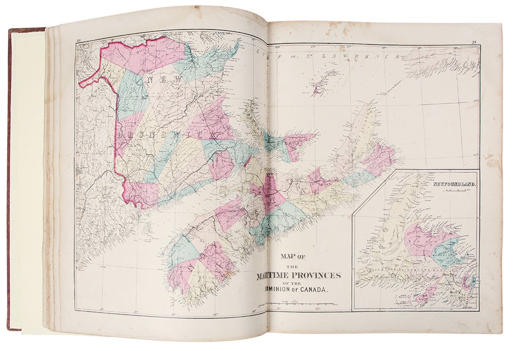
St. John, N. B. and Halifax, N. S. Roe Brothers, 1879. Folio. (15 13/16 x 13 inches). 102 pp. 34 hand-colored mapsheets (5 double-page), many with insets or comprising multiple maps or town plans.
Publisher's black morocco-backed brown cloth boards, upper cover decoratively blocked in black and lettered in gilt, expert repairs to spine.
Scarce hand-colored 19th-century county atlas of the northeastern Canadian provinces.
"This is the only 19th-century atlas of the provinces of New Brunswick, Nova Scotia, and Prince Edward Island." [Rumsey] Following the title is a textual description of the provinces, largely using census data, written by Duncan Campbell, as well as essays on the geology and mineralogy of the region by James Fowler. It was published strictly by subscription at the price of $10 and includes an 8 pp. Business Directory (i.e. essentially a list of subscribers) and 2 pp. publisher's ads in the rear.
Phillips 1239. Rumsey 859.
Item #39575
Price: $3,500.00