

JEFFERYS, Thomas (1719-1771)
A Description of the Spanish Islands and Settlements on the Coast of the West Indies, Compiled from authentic Memoirs, Revised by Gentlemen who have resided many Years in the Spanish Settlements; and Illustrated with Thirty-two Maps and Plans, Chiefly from original Drawings taken from the Spaniards in the last War
London: T. Jefferys, 1762. Quarto. (9 1/4 x 7 3/4 inches). [vi], xxiv, 106 [2] index p., 32 engraved folding maps (one hand-coloured in outline). Uncut.
Original gray paper boards with cloth clamshell box.
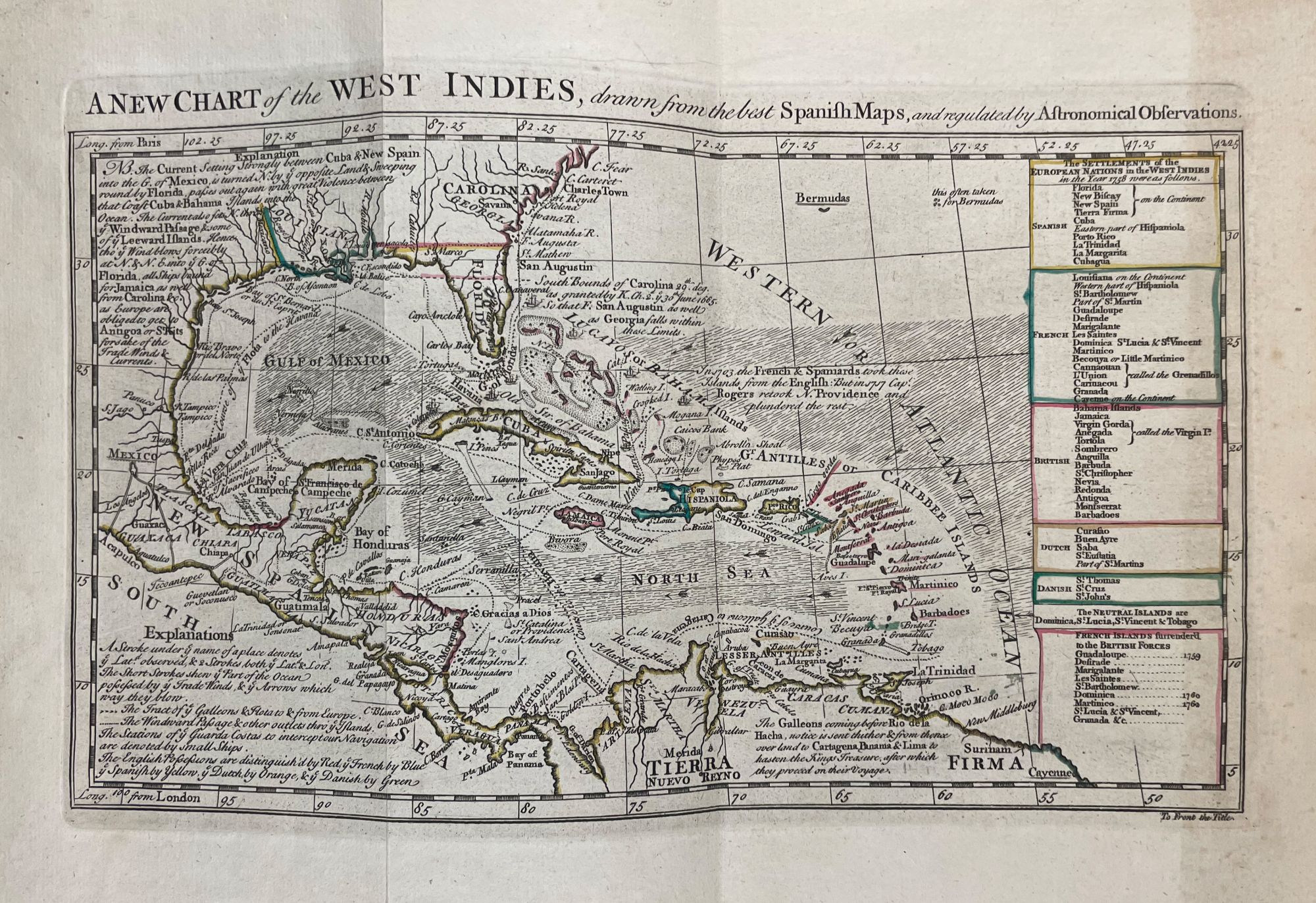
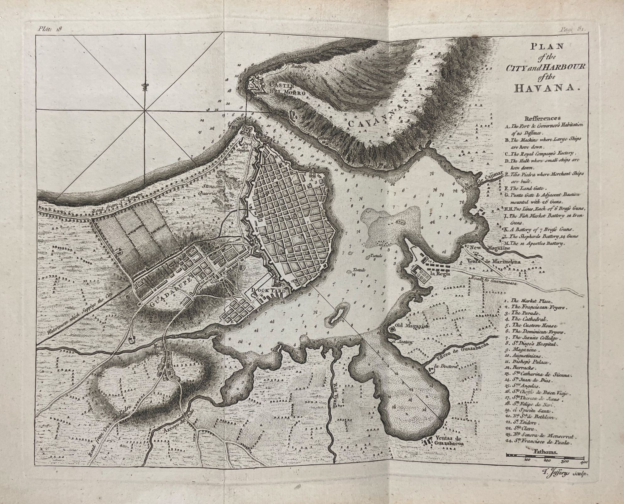
First edition of a noted mid-18th century English work on Spanish America, illustrated with important 32 maps of the region, including the often lacking 'Isthmus of Panama'.
This work was published just following the end of the French and Indian War when England's attention was especially turned towards Spain's colonies in America. The work contains a long Introduction, and special accounts of each of the Colonies, Districts, and important cities. Among the most interesting of the contents are the accounts of Florida, Pensacola, and St. Augustine de la Florida. The charts are based on drawings captured from the Spaniards in the recently-ended war, concentrating on ports and seaboards likely to be of the greatest interest to opportunistic British merchants. Includes the following maps and plans: La Guaira, Puerto Cavello, Santa Martha, Cartagena, Zisapata Bay, Porto Bello, Chagre, Panama, Vera Cruz, Pensacola, St. Augustin, Cuba, Havana, various harbours in Cuba, St Domingo, and Porto Rico, among others.
Phillips Atlases 3941; Sabin 35959; Cox p.220; Cundall 2045; TCB 1328; Palau 123372.
Item #40527
Price: $8,750.00