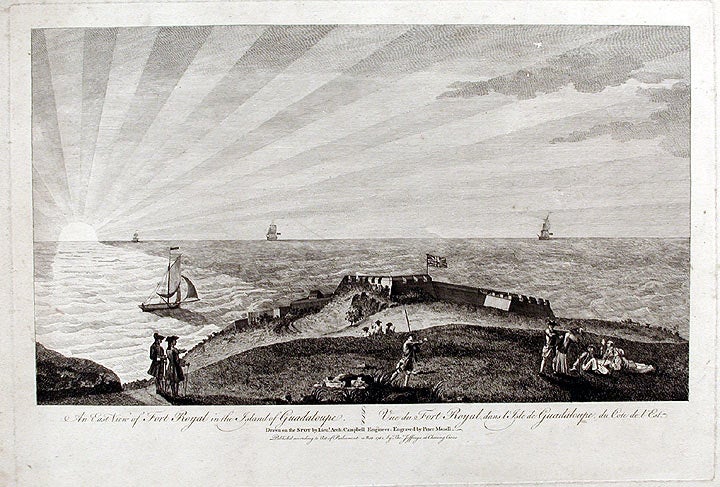

CAMPBELL, After Lieutenant Archibald
An East View of Fort Royal in the Island of Guadaloupe... Drawn on the Spot by Lieut. Arch. Campbell Engineer
London: Thomas Jefferys, November 1762. Engraving, by Peter Mazell. Image size (including text): 11 1/8 x 19 1/2 inches. Sheet size: 18 3/4 x 24 3/4 inches.
A fine and rare image of Guadaloupe in the West Indies, taken during the English occupation of the island from 1759 to 1763.
Fort Royal is situated on the west coast of Basse-Terre (the more rugged of the two islands that make up the bulk of Guadaloupe) and is near the present-day town of Deshaies. The British attempted, unsuccessfully, to capture the French colony of Guadaloupe in 1666, 1691 and 1703, before finally succeeding in 1759. The island was returned to the French in 1763, but captured again, briefly, in April 1794.
Item #5748
Price: $2,400.00